File:Map of the R37 (South Africa).svg
Jump to navigation
Jump to search

Size of this PNG preview of this SVG file: 574 × 600 pixels. Other resolutions: 230 × 240 pixels | 460 × 480 pixels | 735 × 768 pixels | 980 × 1,024 pixels | 1,961 × 2,048 pixels | 741 × 774 pixels.
Original file (SVG file, nominally 741 × 774 pixels, file size: 309 KB)
Captions
Captions
Add a one-line explanation of what this file represents
Summary
[edit].svg&action=edit§ion=1)
| Description |
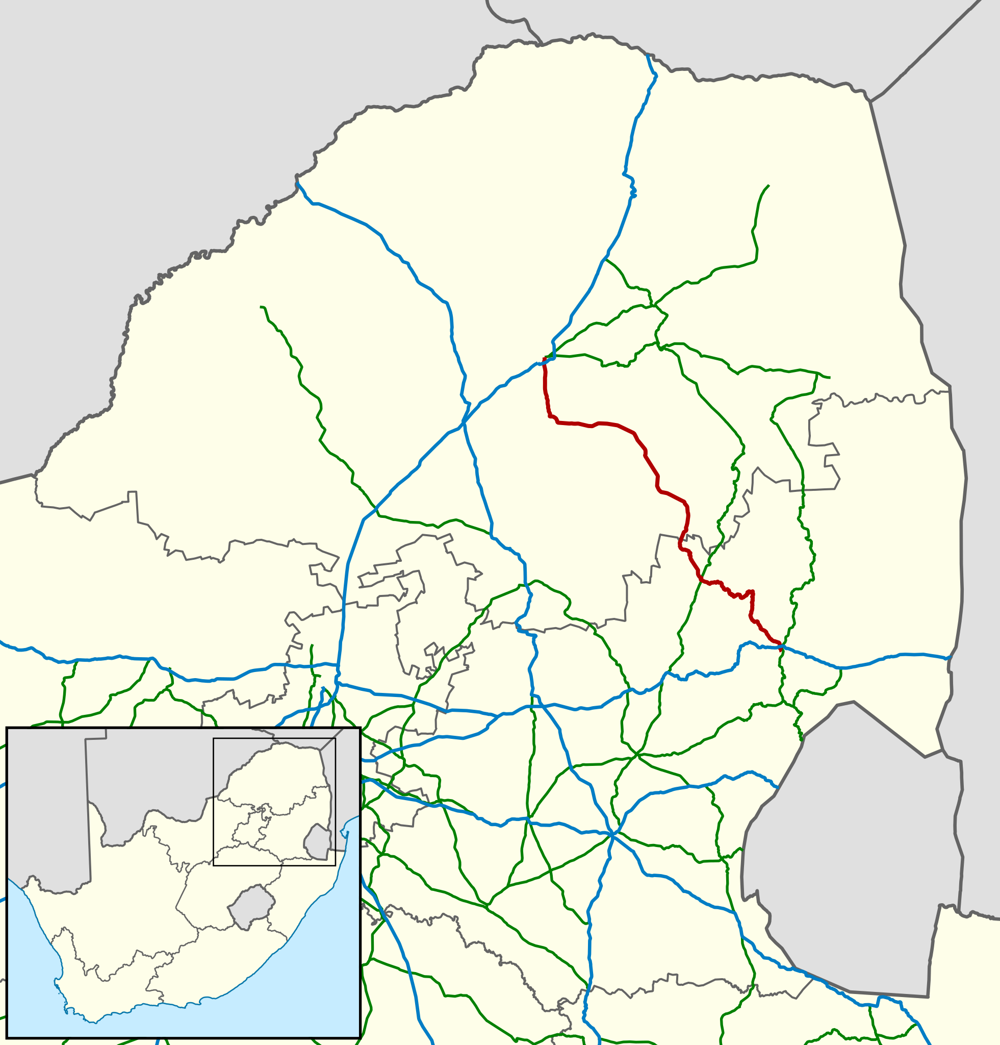
English: Map showing the route of the R37 provincial route, highlighted in red, in Limpopo and Mpumalanga provinces, South Africa. National routes are shown in blue, and other provincial routes in green. |
| Date | |
| Source | Geodata from OpenStreetMap |
| Author | Htonl |
Licensing
[edit].svg&action=edit§ion=2)
This file is licensed under the Creative Commons Attribution-Share Alike 3.0 Unported license.
- You are free:
- to share – to copy, distribute and transmit the work
- to remix – to adapt the work
- Under the following conditions:
- attribution – You must give appropriate credit, provide a link to the license, and indicate if changes were made. You may do so in any reasonable manner, but not in any way that suggests the licensor endorses you or your use.
- share alike – If you remix, transform, or build upon the material, you must distribute your contributions under the same or compatible license as the original.
| This work contains information from OpenStreetMap, which is made available under the Open Database License (ODbL).
The ODbL does not require any particular license for maps produced from ODbL data. Prior to 1 August 2020, map tiles produced by the OpenStreetMap Foundation were licensed under the CC-BY-SA-2.0 license. Maps produced by other people may be subject to other licences. |
File history
Click on a date/time to view the file as it appeared at that time.
| Date/Time | Thumbnail | Dimensions | User | Comment | |
|---|---|---|---|---|---|
| current | 19:38, 10 September 2014 | | 741 × 774 (309 KB) | Htonl (talk | contribs) | Style and projection |
| 18:09, 28 April 2010 |  | 906 × 868 (1.45 MB) | Htonl (talk | contribs) | {{Information |Description={{en|1=Map showing the route of the R37 major regional road, highlighted in red, in Limpopo and Mpumalanga provinces, South Africa. National roads are shown in blue, and other major regional roads in green.}} |Source=Geodata fro |
You cannot overwrite this file.
File usage on Commons
The following 2 pages use this file:
File usage on other wikis
The following other wikis use this file:
- Usage on af.wikipedia.org
- Usage on en.wikipedia.org
- Usage on www.wikidata.org
.svg&oldid=881922680)