File:Map of the Northeastern United States.png
Jump to navigation
Jump to search

Size of this preview: 800 × 495 pixels. Other resolutions: 320 × 198 pixels | 640 × 396 pixels | 1,024 × 633 pixels | 1,280 × 792 pixels | 2,000 × 1,237 pixels.
Original file (2,000 × 1,237 pixels, file size: 411 KB, MIME type: image/png)
Captions
Captions
Add a one-line explanation of what this file represents
Summary
[edit]
| Description |
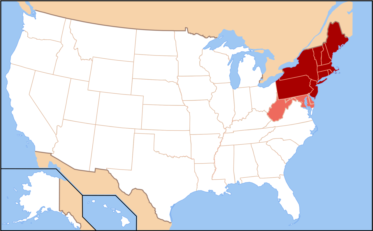
English: Map of the modern definition of the Northeastern United States. States shaded in dark red are those defined by the Census Bureau as part of the Northeast. Those in light red (Delaware, West Virginia, Maryland, and Washington D.C.) are commonly grouped with the Northeast, but are defined as Southeastern by the Census Bureau. |
| Date | |
| Source | Own work |
| Author | 007bond |
| Other versions | Derivative works of this file: Location of Allegheny College in Northeastern United States.png |
Licensing
[edit]
I, the copyright holder of this work, hereby publish it under the following license:
This file is licensed under the Creative Commons Attribution-Share Alike 3.0 Unported license.
- You are free:
- to share – to copy, distribute and transmit the work
- to remix – to adapt the work
- Under the following conditions:
- attribution – You must give appropriate credit, provide a link to the license, and indicate if changes were made. You may do so in any reasonable manner, but not in any way that suggests the licensor endorses you or your use.
- share alike – If you remix, transform, or build upon the material, you must distribute your contributions under the same or compatible license as the original.
File history
Click on a date/time to view the file as it appeared at that time.
| Date/Time | Thumbnail | Dimensions | User | Comment | |
|---|---|---|---|---|---|
| current | 00:41, 10 December 2010 | | 2,000 × 1,237 (411 KB) | 007bond (talk | contribs) | {{Information |Description={{en|1=Map of the modern definition of the Northeastern United States. States shaded in dark red are those defined by the Census Bureau as part of the Northeast. Those in light red (Delaware, West Virginia, Maryland, and Washing |
You cannot overwrite this file.
File usage on Commons
The following page uses this file: