File:Map of the Illinois River Rail Road (NBY 1352).jpg
Jump to navigation
Jump to search

Size of this preview: 397 × 599 pixels. Other resolutions: 159 × 240 pixels | 318 × 480 pixels | 508 × 768 pixels | 678 × 1,024 pixels | 2,384 × 3,600 pixels.
Original file (2,384 × 3,600 pixels, file size: 1.09 MB, MIME type: image/jpeg)
Captions
Captions
Add a one-line explanation of what this file represents
Summary
[edit].jpg&action=edit§ion=1)
| Description |
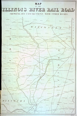
English: Shows the Illinois River Railroad and connecting railroads in Wisconsin, Iowa, Illinois and Missouri. Scale approximately 1,790,000. Detached from, Chief engineer's report. New York, Baker & Godwin, 1858 (opposite title page). |
| Date | |
| Source | https://collections.carli.illinois.edu/cdm/singleitem/collection/nby_chicago/id/1352 |
| Author | Illinois River Railroad Company |
| Permission (Reusing this file) |
The Newberry makes its collections available for any lawful purpose, commercial or non-commercial, without licensing or permission fees to the library, subject to the following terms and conditions: https://www.newberry.org/rights-and-reproductions |
| Format | Maps (Documents) |
| Publisher | Newberry Library |
| Contributors | Mendel, Edward, 1827-1884 |
| References | Detached from, Chief engineers report, presenting characteristics of location... and map showing its position |
| Subject | Illinois River Railroad Company Railroads |
| Production Number | map4F G4101.P3 1858 I4 |
Licensing
[edit].jpg&action=edit§ion=2)
|
This work is in the public domain in its country of origin and other countries and areas where the copyright term is the author's life plus 100 years or fewer. This work is in the public domain in the United States because it was published (or registered with the U.S. Copyright Office) before January 1, 1929. | |
| This file has been identified as being free of known restrictions under copyright law, including all related and neighboring rights. | |
File history
Click on a date/time to view the file as it appeared at that time.
| Date/Time | Thumbnail | Dimensions | User | Comment | |
|---|---|---|---|---|---|
| current | 13:46, 1 March 2018 | | 2,384 × 3,600 (1.09 MB) | Fæ (talk | contribs) | Newberry Library nby_chicago 1352 # 11 |
You cannot overwrite this file.
File usage on Commons
There are no pages that use this file.
.jpg&oldid=489872946)