File:Map of the European Long Distance Path E12.png
Jump to navigation
Jump to search
Size of this preview: 587 × 600 pixels. Other resolutions: 235 × 240 pixels | 470 × 480 pixels | 752 × 768 pixels | 1,002 × 1,024 pixels | 1,835 × 1,875 pixels.
Original file (1,835 × 1,875 pixels, file size: 2.64 MB, MIME type: image/png)
Captions
Captions
Add a one-line explanation of what this file represents
Summary
[edit]| Description |
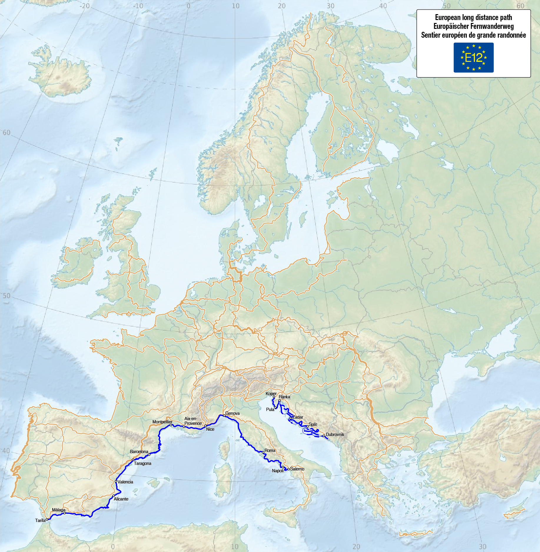
Deutsch: Karte des Europäischen Fernwanderwegs E12
English: Map of the European long distance path E12
Français : Carte du sentier européen de grande randonnée E12 |
| Date | see file history |
| Source |
Own work, using
The information of the contents is from the following sources: |
| Author | Maximilian Dörrbecker (Chumwa) |
| Permission (Reusing this file) |
I, the copyright holder of this work, hereby publish it under the following license: This file is licensed under the Creative Commons Attribution-Share Alike 3.0 Unported license.
Sie dürfen das Bild zu den folgenden Bedingungen nutzen:
|
| Other versions |
|


|
This map has been made or improved in the German Kartenwerkstatt (Map Lab). You can propose maps to improve as well.
|
File history
Click on a date/time to view the file as it appeared at that time.
| Date/Time | Thumbnail | Dimensions | User | Comment | |
|---|---|---|---|---|---|
| current | 07:06, 13 February 2016 | | 1,835 × 1,875 (2.64 MB) | Chumwa (talk | contribs) | E12 in Kroatien ergänzt |
| 17:12, 14 June 2015 |  | 1,835 × 1,875 (2.63 MB) | Chumwa (talk | contribs) |
You cannot overwrite this file.
File usage on Commons
The following 21 pages use this file:
- User:Chumwa/Gallery
- User:Chumwa/OgreBot/Potential transport maps/2016 February 10-19
- User:Chumwa/OgreBot/Transport Maps/2015 June 11-20
- User:Chumwa/OgreBot/Transport Maps/2016 February 10-19
- User:Chumwa/OgreBot/Travel and communication maps/2016 February 10-19
- User:Chumwa/gallery
- File:Map of the European Long Distance Path E1.png
- File:Map of the European Long Distance Path E10.png
- File:Map of the European Long Distance Path E11.png
- File:Map of the European Long Distance Path E12.png
- File:Map of the European Long Distance Path E2.png
- File:Map of the European Long Distance Path E3.png
- File:Map of the European Long Distance Path E4.png
- File:Map of the European Long Distance Path E5.png
- File:Map of the European Long Distance Path E6.png
- File:Map of the European Long Distance Path E7.png
- File:Map of the European Long Distance Path E8.png
- File:Map of the European Long Distance Path E9.png
- File:Map of the European Long Distance Paths.png
- File:Map of the European long distance paths.svg
- Category:E12 European long distance path
File usage on other wikis
The following other wikis use this file:
- Usage on de.wikipedia.org
- Usage on de.wikivoyage.org
- Usage on en.wikipedia.org
- Usage on en.wikivoyage.org
- Usage on fi.wikipedia.org
- Usage on fr.wikipedia.org
- Usage on it.wikipedia.org
- Usage on nl.wikipedia.org
- Usage on ru.wikipedia.org
- Usage on sl.wikipedia.org
- Usage on www.wikidata.org