File:Map of the City of Cleveland (1898) - DPLA - 5df6b217f8ad4e48a13445f6c6caa013.jpg
Jump to navigation
Jump to search

Size of this preview: 800 × 559 pixels. Other resolutions: 320 × 224 pixels | 640 × 447 pixels | 1,024 × 716 pixels | 1,280 × 895 pixels | 2,560 × 1,789 pixels | 5,119 × 3,578 pixels.
Original file (5,119 × 3,578 pixels, file size: 2.28 MB, MIME type: image/jpeg)
Captions
Captions
Add a one-line explanation of what this file represents
Summary
[edit]| Map of the City of Cleveland (1898)
( |
|||||||||||||||||||||
|---|---|---|---|---|---|---|---|---|---|---|---|---|---|---|---|---|---|---|---|---|---|
| Creator | Whitworth Bros | ||||||||||||||||||||
| Title |
Map of the City of Cleveland (1898) |
||||||||||||||||||||
| Description |
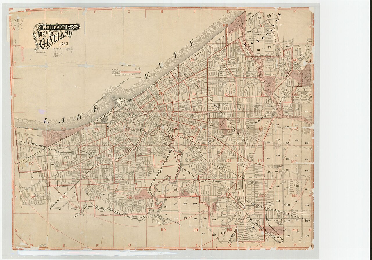
Map shows Cleveland's lakefront, landmarks, city limits, car lines, parks, cemeteries, streets, ward numbers and boundaries, inset downtown. |
||||||||||||||||||||
| Date | 1898 | ||||||||||||||||||||
| Collection |
|
||||||||||||||||||||
| Source/Photographer |
|
||||||||||||||||||||
| Permission (Reusing this file) |
|
||||||||||||||||||||
| Standardized rights statement |
|
||||||||||||||||||||


_-_DPLA_-_5df6b217f8ad4e48a13445f6c6caa013.jpg&action=edit§ion=1)
File history
Click on a date/time to view the file as it appeared at that time.
| Date/Time | Thumbnail | Dimensions | User | Comment | |
|---|---|---|---|---|---|
| current | 23:21, 22 April 2022 | | 5,119 × 3,578 (2.28 MB) | DPLA bot (talk | contribs) | Uploading DPLA ID 5df6b217f8ad4e48a13445f6c6caa013 |
You cannot overwrite this file.
File usage on Commons
The following page uses this file:
_-_DPLA_-_5df6b217f8ad4e48a13445f6c6caa013.jpg)
_-_DPLA_-_5df6b217f8ad4e48a13445f6c6caa013.jpg&oldid=886886309)