File:Map of ogasawara islands-PL.png
Jump to navigation
Jump to search

Size of this preview: 760 × 600 pixels. Other resolutions: 304 × 240 pixels | 608 × 480 pixels | 973 × 768 pixels | 1,053 × 831 pixels.
Original file (1,053 × 831 pixels, file size: 904 KB, MIME type: image/png)
Captions
Captions
Add a one-line explanation of what this file represents
Summary
[edit]
| Description |
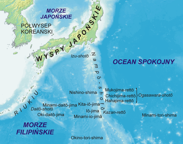
Map of Japanese island in Oceania (Ogasawara-shotō, Kazan-rettō, Minami-tori-shima, Okino-tori-shima i Daitō-shotō) in Polish. Mapa japońskich wysp w Oceanii (Ogasawara-shotō, Kazan-rettō, Minami-tori-shima, Okino-tori-shima i Daitō-shotō). |
| Date | 19 October 2006 (original upload date) |
| Source | No machine-readable source provided. Own work assumed (based on copyright claims). |
| Author | No machine-readable author provided. Aotearoa assumed (based on copyright claims). |
Licensing
[edit]
| I, the copyright holder of this work, release this work into the public domain. This applies worldwide. In some countries this may not be legally possible; if so: I grant anyone the right to use this work for any purpose, without any conditions, unless such conditions are required by law. |
File history
Click on a date/time to view the file as it appeared at that time.
| Date/Time | Thumbnail | Dimensions | User | Comment | |
|---|---|---|---|---|---|
| current | 18:31, 19 October 2006 | | 1,053 × 831 (904 KB) | Aotearoa (talk | contribs) | |
| 18:14, 19 October 2006 |  | 4,212 × 3,324 (3.66 MB) | Aotearoa (talk | contribs) | Map of Japanese island in Oceania (Ogasawara-shotō, Kazan-rettō, Minami-tori-shima, Okino-tori-shima i Daitō-shotō) in Polish. Mapa japońskich wysp w Oceanii (Ogasawara-shotō, Kazan-rettō, Minami-tori-shima, Okino-tori-shima i Daitō-shotō). |
You cannot overwrite this file.
File usage on Commons
There are no pages that use this file.
File usage on other wikis
The following other wikis use this file:
- Usage on pl.wikipedia.org