File:Map of all Czech towns and cities.jpg
Jump to navigation
Jump to search
Size of this preview: 800 × 526 pixels. Other resolutions: 320 × 211 pixels | 640 × 421 pixels | 1,024 × 674 pixels | 1,280 × 842 pixels | 2,000 × 1,316 pixels.
Original file (2,000 × 1,316 pixels, file size: 746 KB, MIME type: image/jpeg)
Captions
Captions
Add a one-line explanation of what this file represents
Summary
[edit]
| Description |
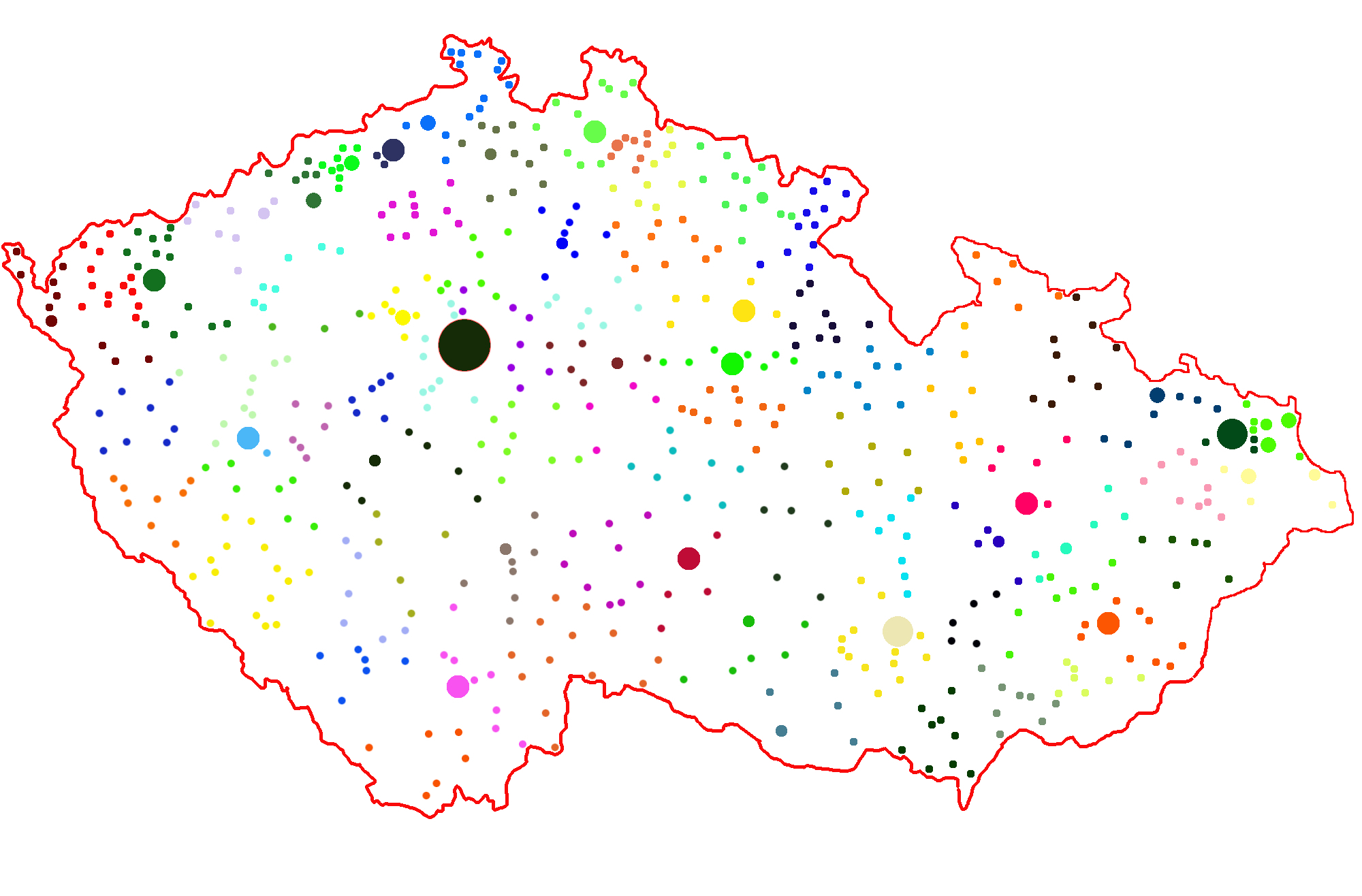
Čeština: Mapa obcí se statusem města - barevně odlišeno dle okresů. Poznámka k velikosti puntíků: Praha, Brno, Ostrava přibližně odpovídají velikosti v reálu. Dále zvýrazněna krajská města, města nad 50 000 obyvatel a města 30-50 000 obyvatel. Zobrazeno by mělo být 594 měst (stav: 2010), počet obyvatel však dle staršího seznamu (snad 2008).
English: Towns and cities of the Czech Republic. Each color represents a different "okres" (district). Note to the size of the dotes: Prague, Brno and Ostrava are approximately in its real size ratio. Seats of regions (kraj) something bigger, the same like towns greater than 50 000 inhabitants (stand: 2008!) and 30-50 000 inhabitants (2008!); there should be, however, all 594 towns and cities as in 2010. |
| Date | |
| Source | Own work |
| Author | Aeromix |
| Other versions | Derivative works of this file: Map of all Czech towns and cities2.jpg |
Licensing
[edit]
I, the copyright holder of this work, hereby publish it under the following license:
This file is licensed under the Creative Commons Attribution 3.0 Unported license.
- You are free:
- to share – to copy, distribute and transmit the work
- to remix – to adapt the work
- Under the following conditions:
- attribution – You must give appropriate credit, provide a link to the license, and indicate if changes were made. You may do so in any reasonable manner, but not in any way that suggests the licensor endorses you or your use.
File history
Click on a date/time to view the file as it appeared at that time.
| Date/Time | Thumbnail | Dimensions | User | Comment | |
|---|---|---|---|---|---|
| current | 21:04, 5 November 2010 | | 2,000 × 1,316 (746 KB) | Aeromix (talk | contribs) | {{Information |Description={{cs|1=Mapa obcí se statusem města - barevně odlišeno dle okresů. Poznámka k velikosti puntíků: Praha, Brno, Ostrava přibližně odpovídají velikosti v reálu. Dále zvýrazněna krajská města, města nad 50 000 oby |
You cannot overwrite this file.
File usage on Commons
The following page uses this file:
File usage on other wikis
The following other wikis use this file:
- Usage on sk.wikipedia.org