File:Map of West Virginia highlighting Fayette County.svg
Jump to navigation
Jump to search

Size of this PNG preview of this SVG file: 672 × 600 pixels. Other resolutions: 269 × 240 pixels | 538 × 480 pixels | 860 × 768 pixels | 1,147 × 1,024 pixels | 2,294 × 2,048 pixels | 1,220 × 1,089 pixels.
Original file (SVG file, nominally 1,220 × 1,089 pixels, file size: 82 KB)
Captions
Captions
Add a one-line explanation of what this file represents
Summary
[edit]
| Description |
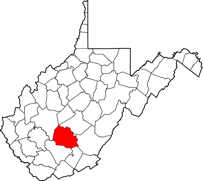
English: This is a locator map showing Fayette County in West Virginia. For more information, see Commons:United States county locator maps. |
| Date | |
| Source |
Own work: English: The maps use data from nationalatlas.gov, specifically countyp020.tar.gz on the Raw Data Download page. The maps also use state outline data from statesp020.tar.gz. The Florida maps use hydrogm020.tar.gz to display Lake Okeechobee. |
| Author | David Benbennick |
| SVG development | This W3C-invalid vector image was created with an unknown SVG tool. |
Licensing
[edit]
| I, the copyright holder of this work, release this work into the public domain. This applies worldwide. In some countries this may not be legally possible; if so: I grant anyone the right to use this work for any purpose, without any conditions, unless such conditions are required by law. |
File history
Click on a date/time to view the file as it appeared at that time.
| Date/Time | Thumbnail | Dimensions | User | Comment | |
|---|---|---|---|---|---|
| current | 23:48, 24 June 2024 | | 1,220 × 1,089 (82 KB) | Nux (talk | contribs) | fix rendering (remove clipping) |
| 23:18, 21 June 2024 |  | 4,270 × 3,810 (110 KB) | Glrx (talk | contribs) | neuter the clipping path // Editing SVG source code using c:User:Rillke/SVGedit.js | |
| 18:08, 12 February 2006 |  | 4,270 × 3,810 (110 KB) | David Benbennick (talk | contribs) | {{subst:User:Dbenbenn/clm|county=Fayette County|state=West Virginia|type=county}} |
You cannot overwrite this file.
File usage on Commons
The following 7 pages use this file:
- Commons:Graphics village pump
- Category:Births in Fayette County, West Virginia
- Category:Fayette County, West Virginia
- Category:Maps of Fayette County, West Virginia
- Category:National Register of Historic Places in Fayette County, West Virginia
- Category:People of Fayette County, West Virginia
- Category:Populated places in Fayette County, West Virginia
File usage on other wikis
The following other wikis use this file:
- Usage on ar.wikipedia.org
- Usage on bg.wikipedia.org
- Usage on bpy.wikipedia.org
- Usage on cdo.wikipedia.org
- Usage on ceb.wikipedia.org
- Usage on ce.wikipedia.org
- Usage on cy.wikipedia.org
- Usage on de.wikipedia.org
- Usage on en.wikipedia.org
- List of counties in West Virginia
- Fayette County, West Virginia
- Ansted, West Virginia
- Fayetteville, West Virginia
- Gauley Bridge, West Virginia
- Meadow Bridge, West Virginia
- Mount Hope, West Virginia
- Oak Hill, West Virginia
- Pax, West Virginia
- Powellton, West Virginia
- Thurmond, West Virginia
- Montgomery, West Virginia
- Smithers, West Virginia
- Page, West Virginia
- Deep Water, West Virginia
- Kimberly, Fayette County, West Virginia
- Clifftop, Fayette County, West Virginia
- Pine Grove, Fayette County, West Virginia
- Glen Ferris, West Virginia
- Price Hill, Fayette County, West Virginia
- Fayette, West Virginia
- Template:Fayette County, West Virginia
- Minden, West Virginia
- Belva, West Virginia
- User:Nyttend/County templates/WV
- Glen Jean, West Virginia
- Robson, West Virginia
- Beards Fork, West Virginia
- Prince, West Virginia
- User:WVnativeson/sandbox14
- Edmond, West Virginia
- National Register of Historic Places listings in Fayette County, West Virginia
- Kay Moor, West Virginia
- Hopewell, Fayette County, West Virginia
- Mossy, West Virginia
- Mahan, West Virginia
- Alta, Fayette County, West Virginia
- Nallen, West Virginia
- Russellville, West Virginia
- Landisburg, West Virginia
- Whipple, West Virginia
View more global usage of this file.