File:Map of Waco McLennan County Texas.jpg
Jump to navigation
Jump to search
Size of this preview: 440 × 600 pixels. Other resolutions: 176 × 240 pixels | 352 × 480 pixels | 830 × 1,131 pixels.
Original file (830 × 1,131 pixels, file size: 189 KB, MIME type: image/jpeg)
Captions
Captions
Add a one-line explanation of what this file represents
Summary
[edit]| Description |
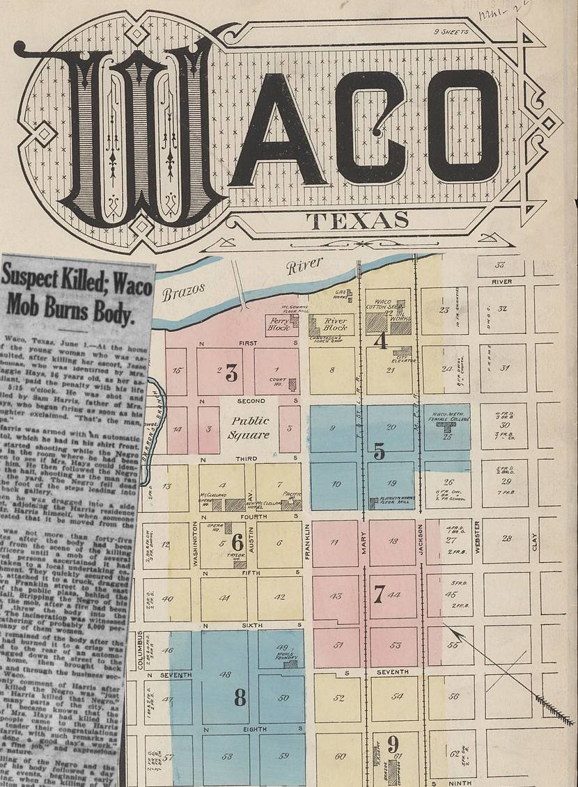
English: Map of Waco showing location of the 1922 burning Jesse Thomas |
||||||
| Date | |||||||
| Source | |||||||
| Author | |||||||
| Permission (Reusing this file) |
|


File history
Click on a date/time to view the file as it appeared at that time.
| Date/Time | Thumbnail | Dimensions | User | Comment | |
|---|---|---|---|---|---|
| current | 23:06, 6 March 2022 | | 830 × 1,131 (189 KB) | Thats Just Great (talk | contribs) | {{Information |Description={{en|Map of Waco showing location of the 1922 burning Jesse Thomas}} |Source= *File:Sanborn Fire Insurance Map from Waco, McLennan County, Texas. LOC sanborn08803 001-1.jpg *[https://chroniclingamerica.loc.gov/lccn/sn83025779/1922-06-03/ed-1/seq-1/# The Dallas Express June 3, 1922] |Date= *File:Sanborn Fire Insurance Map from Waco, McLennan County, Texas. LOC sanborn08803 001-1.jpg *[https://chroniclingamerica.loc.gov/lccn/sn83025779/1922-06-03/ed-1/seq-1/... |
You cannot overwrite this file.
File usage on Commons
There are no pages that use this file.
File usage on other wikis
The following other wikis use this file:
- Usage on en.wikipedia.org