File:Map of Vermont highlighting Washington County.svg
Jump to navigation
Jump to search

Size of this PNG preview of this SVG file: 368 × 599 pixels. Other resolutions: 147 × 240 pixels | 295 × 480 pixels | 472 × 768 pixels | 629 × 1,024 pixels | 1,259 × 2,048 pixels | 627 × 1,020 pixels.
Original file (SVG file, nominally 627 × 1,020 pixels, file size: 17 KB)
Captions
Captions
Add a one-line explanation of what this file represents
Summary
[edit]
| Description |
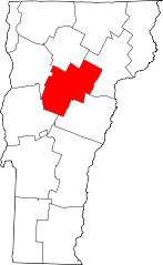
English: This is a locator map showing Washington County in Vermont. For more information, see Commons:United States county locator maps. |
| Date | |
| Source |
Own work: English: The maps use data from nationalatlas.gov, specifically countyp020.tar.gz on the Raw Data Download page. The maps also use state outline data from statesp020.tar.gz. The Florida maps use hydrogm020.tar.gz to display Lake Okeechobee. |
| Author | David Benbennick |
| SVG development |
Licensing
[edit]
| I, the copyright holder of this work, release this work into the public domain. This applies worldwide. In some countries this may not be legally possible; if so: I grant anyone the right to use this work for any purpose, without any conditions, unless such conditions are required by law. |
File history
Click on a date/time to view the file as it appeared at that time.
| Date/Time | Thumbnail | Dimensions | User | Comment | |
|---|---|---|---|---|---|
| current | 21:56, 24 June 2024 | | 627 × 1,020 (17 KB) | Nux (talk | contribs) | fix rendering (remove clipping) |
| 17:36, 12 February 2006 |  | 1,567 × 2,550 (29 KB) | David Benbennick (talk | contribs) | {{subst:User:Dbenbenn/clm|county=Washington County|state=Vermont|type=county}} |
You cannot overwrite this file.
File usage on Commons
The following 8 pages use this file:
- Category:Bridges in Washington County, Vermont
- Category:Deaths in Washington County, Vermont
- Category:Geography of Washington County, Vermont
- Category:Maps of Washington County, Vermont
- Category:People of Washington County, Vermont
- Category:Populated places in Washington County, Vermont
- Category:Towns in Washington County, Vermont
- Category:Washington County, Vermont
File usage on other wikis
The following other wikis use this file:
- Usage on ar.wikipedia.org
- مونبلييه (فيرمونت)
- بلدة باري (فيرمونت)
- برلين (فيرمونت)
- كابوت (فيرمونت)
- كاليس (فيرمونت)
- دوكسبوري (فيرمونت)
- إيست مونبلير (فيرمونت)
- فايستون (فيرمونت)
- ميدلسكس (فيرمونت)
- مورتاون (فيرمونت)
- نورثفيلد (فيرمونت)
- بلينفيلد (فيرمونت)
- روكسبري (فيرمونت)
- ويتفيلد (فيرمونت)
- وارن (فيرمونت)
- واتربوري (فيرمونت)
- وودبوري (فيرمونت)
- ووستر (فيرمونت)
- باري (فيرمونت)
- قرية كابوت (فيرمونت)
- قرية مارشفيلد (فيرمونت)
- قرية نورثفيلد (فيرمونت)
- ووتربيري (فيرمونت)
- قائمة مقاطعات فيرمونت
- مقاطعة واشنطن (فيرمونت)
- ساوث باري (فيرمونت)
- قالب:مقاطعة واشنطن (فيرمونت)
- Usage on arz.wikipedia.org
- Usage on ast.wikipedia.org
- Usage on bg.wikipedia.org
- Usage on bpy.wikipedia.org
- Usage on ca.wikipedia.org
- Montpelier
- Barre (town de Vermont)
- Barre (ciutat de Vermont)
- Berlin (Vermont)
- Cabot (Vermont)
- Calais (Vermont)
- Duxbury (Vermont)
- East Montpelier
- Fayston
- Graniteville-East Barre
- Middlesex (Vermont)
- Moretown
- Northfield (Vermont)
- Plainfield (Vermont)
- Roxbury (Vermont)
- South Barre
- Waitsfield
- Warren (Vermont)
View more global usage of this file.