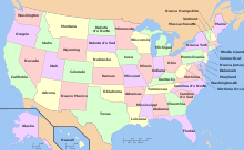
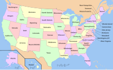
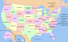
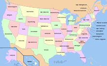
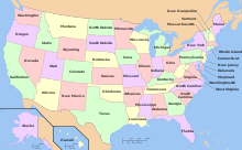
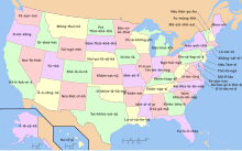
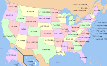
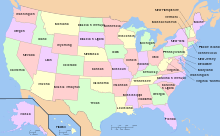
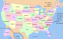
File:Map of USA with state names fa.svg
From Wikimedia Commons, the free media repository
Jump to navigation
Jump to search

Size of this PNG preview of this SVG file: 800 × 495 pixels. Other resolutions: 320 × 198 pixels | 640 × 396 pixels | 1,024 × 633 pixels | 1,280 × 791 pixels | 2,560 × 1,583 pixels | 959 × 593 pixels.
Original file (SVG file, nominally 959 × 593 pixels, file size: 332 KB)
File information
Structured data
Captions
Captions
Add a one-line explanation of what this file represents
| This is a retouched picture, which means that it has been digitally altered from its original version. Modifications: Persian version. The original can be viewed here: Map of USA with state names.svg:
|

|
Permission is granted to copy, distribute and/or modify this document under the terms of the GNU Free Documentation License, Version 1.2 or any later version published by the Free Software Foundation; with no Invariant Sections, no Front-Cover Texts, and no Back-Cover Texts. A copy of the license is included in the section entitled GNU Free Documentation License.http://www.gnu.org/copyleft/fdl.htmlGFDLGNU Free Documentation Licensetruetrue |
| This file is licensed under the Creative Commons Attribution-Share Alike 3.0 Unported license. | ||
| ||
| This licensing tag was added to this file as part of the GFDL licensing update.http://creativecommons.org/licenses/by-sa/3.0/CC BY-SA 3.0Creative Commons Attribution-Share Alike 3.0truetrue |
Original upload log
[edit]This image is a derivative work of the following images:
- File:Map_of_USA_with_state_names.svg licensed with Cc-by-sa-3.0,2.5,2.0,1.0, GFDL
- 2007-06-11T13:23:48Z Andrew c 959x593 (339488 Bytes)
- 2007-04-17T06:15:06Z Andrew c 959x593 (336711 Bytes)
- 2005-12-28T18:36:54Z Dbenbenn 959x593 (317355 Bytes) fix error in
- 2005-10-09T22:14:30Z Dbenbenn 959x593 (339217 Bytes) fixed by [[User:Ed g2s]] (removed tag), and me (removed undisplayed shapes: rivers, lakes, capitals, highways. Cropped. Fixed typos.)
- 2005-10-09T22:12:53Z Dbenbenn 990x855 (978926 Bytes) original version from [[w:Image:Map of USA with state names.svg]] by [[w:User:Wapcaplet]], cc-by-2.0
Uploaded with derivativeFX
File history
Click on a date/time to view the file as it appeared at that time.
| Date/Time | Thumbnail | Dimensions | User | Comment | |
|---|---|---|---|---|---|
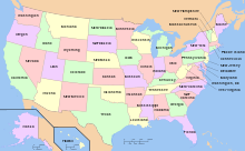
| current | 17:45, 27 September 2011 |  | 959 × 593 (332 KB) | Ladsgroup (talk | contribs) | revert+correction of carolina |
| 17:40, 27 September 2011 |  | 959 × 593 (264 KB) | Ladsgroup (talk | contribs) | some minor correction | |
| 19:27, 14 April 2009 |  | 959 × 593 (332 KB) | Ladsgroup (talk | contribs) | {{Information |Description=A compass of the United States, with state names. The original was edited by User:Andrew c to include Nova Scotia, PEI, Bahamas, and scale key. It was originally uploaded to the English Wikipedia with the same title by |
You cannot overwrite this file.
File usage on Commons
The following 48 pages use this file:
- File:EstatsEUA.png
- File:Map of USA showing state names in Persian.jpg
- File:Map of USA with state names.svg
- File:Map of USA with state names ar.svg
- File:Map of USA with state names as.svg
- File:Map of USA with state names bg.svg
- File:Map of USA with state names bn.svg
- File:Map of USA with state names bpy.svg
- File:Map of USA with state names bs.svg
- File:Map of USA with state names ce.svg
- File:Map of USA with state names chr.svg
- File:Map of USA with state names el.svg
- File:Map of USA with state names eo.svg
- File:Map of USA with state names es.svg
- File:Map of USA with state names et.svg
- File:Map of USA with state names eu.svg
- File:Map of USA with state names fa.svg
- File:Map of USA with state names fr.svg
- File:Map of USA with state names gl.svg
- File:Map of USA with state names grc.png
- File:Map of USA with state names haw.svg
- File:Map of USA with state names he.svg
- File:Map of USA with state names hi.png
- File:Map of USA with state names hi.svg
- File:Map of USA with state names hr.svg
- File:Map of USA with state names it.svg
- File:Map of USA with state names ka.png
- File:Map of USA with state names kk.png
- File:Map of USA with state names mk.svg
- File:Map of USA with state names mr.svg
- File:Map of USA with state names nv.svg
- File:Map of USA with state names pt.svg
- File:Map of USA with state names ru(2).svg
- File:Map of USA with state names ru.svg
- File:Map of USA with state names sco.svg
- File:Map of USA with state names sk.svg
- File:Map of USA with state names sr.svg
- File:Map of USA with state names sv.svg
- File:Map of USA with state names th.svg
- File:Map of USA with state names uk.svg
- File:Map of USA with state names ur.svg
- File:Map of USA with state names zh-hans.svg
- File:Map of USA with state names zh-hant.svg
- File:Ovtâstum staatâi uásistaatah smn.svg
- File:USA map with state names pl.svg
- File:USA map with state names szl.svg
- File:Yhdysvaltain osavaltiot.svg
- Template:Other versions/Map of USA with state names
File usage on other wikis
The following other wikis use this file:
- Usage on azb.wikipedia.org
- Usage on fa.wikipedia.org
- Usage on mzn.wikipedia.org


