File:Map of Thera before the Minoan eruption (Druitt, Francaviglia).png
Jump to navigation
Jump to search

Size of this preview: 520 × 599 pixels. Other resolutions: 208 × 240 pixels | 417 × 480 pixels | 667 × 768 pixels | 1,171 × 1,349 pixels.
Original file (1,171 × 1,349 pixels, file size: 173 KB, MIME type: image/png)
Captions
Captions
Add a one-line explanation of what this file represents
| Description |
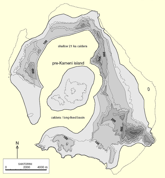
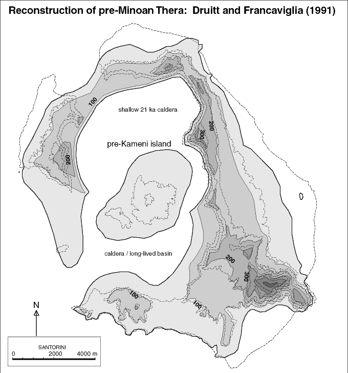
Deutsch: Karte der Insel Thera vor der Minoischen Eruption. Rekonstruktion nach Timothy H. Druitt und Vincenzo Francaviglia (1991). Die vulkanischen Küstenlinien der Mittelinsel und des nordwestlichen Rands der Caldera sind spekulativ, alle anderen Küsten bezeichnen die Autoren als „sicher“ oder „weniger sicher“.
English: Map of Thera island before the Minoan eruption |
| Date | see file history of this file |
| Source |
Own work, using
|
| Author | Maximilian Dörrbecker (Chumwa) |
| Permission (Reusing this file) |
I, the copyright holder of this work, hereby publish it under the following license: This file is licensed under the Creative Commons Attribution-Share Alike 2.5 Generic license.
Sie dürfen das Bild zu den folgenden Bedingungen nutzen:
|
| Other versions | Map of Thera before the Minoan eruption.png |
File history
Click on a date/time to view the file as it appeared at that time.
| Date/Time | Thumbnail | Dimensions | User | Comment | |
|---|---|---|---|---|---|
| current | 07:10, 28 February 2016 | | 1,171 × 1,349 (173 KB) | Chumwa (talk | contribs) | |
| 21:57, 27 February 2016 |  | 1,171 × 1,349 (172 KB) | Oltau (talk | contribs) | {{Information |Description= {{de|Karte der Insel Thera vor der Minoischen Eruption}} {{en|Map of Thera island before the Minoan eruption}} |Source={{Own}}, using * this file by {{U|FinnWikiNo}} * [[:File:Santorin.png|this f... |
You cannot overwrite this file.
File usage on Commons
The following page uses this file:
File usage on other wikis
The following other wikis use this file:
- Usage on de.wikipedia.org
- Usage on et.wikipedia.org
- Usage on fr.wikipedia.org
.png&oldid=745659585)