File:Map of Sveaborg in 1808 (russian language).jpg
Jump to navigation
Jump to search

Size of this preview: 394 × 600 pixels. Other resolutions: 157 × 240 pixels | 315 × 480 pixels | 504 × 768 pixels | 672 × 1,024 pixels | 1,408 × 2,144 pixels.
Original file (1,408 × 2,144 pixels, file size: 405 KB, MIME type: image/jpeg)
Captions
Captions
Add a one-line explanation of what this file represents
Summary
[edit].jpg&action=edit§ion=1)
| Description |
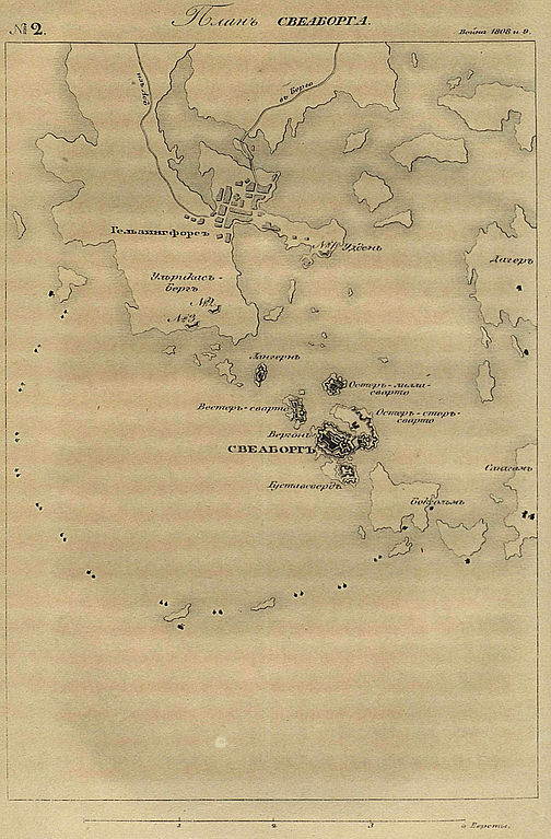
English: Map of Sveaborg in 1808 (on russian_language)
Русский: План Гельсингфорса и Свеаборгских укреплений в 1808 году |
|||||||||
| Date | ||||||||||
| Source | Михайловский-Данилевский А. И. Описание Финляндской войны на сухом пути и на море в 1808 и 1809 годах. — СПб., 1841. — С. 220 | |||||||||
| Creator | ||||||||||
| Geotemporal data | ||||||||||
| Bounding box |
|
|||||||||
| Georeferencing | ||||||||||
Licensing
[edit].jpg&action=edit§ion=2)
|
This work is in the public domain in its country of origin and other countries and areas where the copyright term is the author's life plus 70 years or fewer. | |
| This file has been identified as being free of known restrictions under copyright law, including all related and neighboring rights. | |
File history
Click on a date/time to view the file as it appeared at that time.
| Date/Time | Thumbnail | Dimensions | User | Comment | |
|---|---|---|---|---|---|
| current | 10:48, 7 September 2011 | | 1,408 × 2,144 (405 KB) | Netelo (talk | contribs) | {{Information |Description ={{en|1=Map of Sveaborg in 1808 (on russian_language)}} {{ru|1=План Гельсингфорса и Свеаборгских укреплений в 1808 году}} |Source =[http://dlib.rsl.ru/view.php?path=/rsl010 |
You cannot overwrite this file.
File usage on Commons
There are no pages that use this file.
File usage on other wikis
The following other wikis use this file:
- Usage on ru.wikipedia.org
- Usage on www.wikidata.org
.jpg&oldid=890624299)