File:Map of South Atlantic Express submarine cable route.svg
Jump to navigation
Jump to search

Size of this PNG preview of this SVG file: 800 × 592 pixels. Other resolutions: 320 × 237 pixels | 640 × 473 pixels | 1,024 × 757 pixels | 1,280 × 947 pixels | 2,560 × 1,893 pixels | 1,321 × 977 pixels.
Original file (SVG file, nominally 1,321 × 977 pixels, file size: 1.6 MB)
Captions
Captions
Add a one-line explanation of what this file represents
Summary
[edit]
| Description |
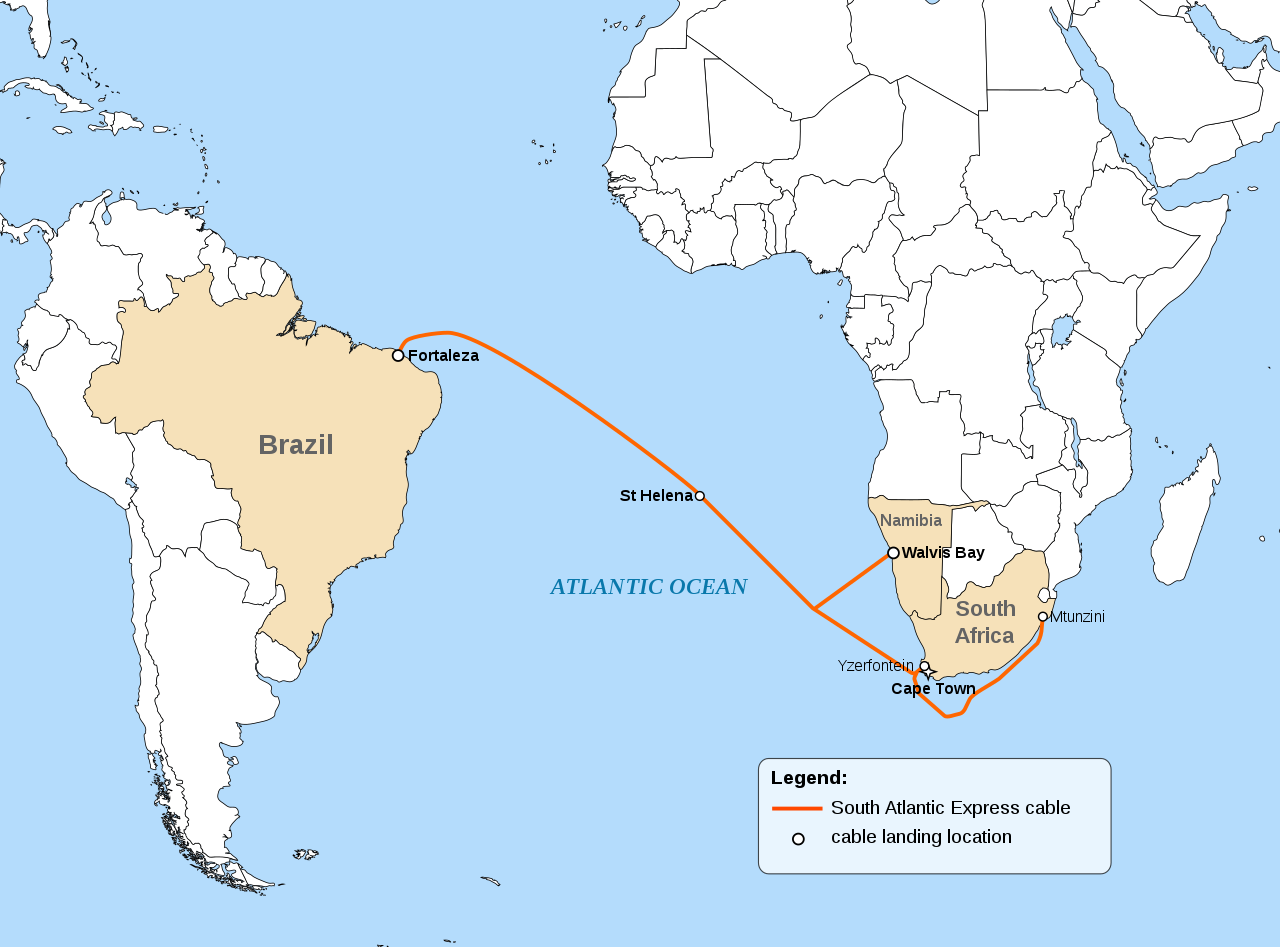
English: Map of South Atlantic Express (SAex) submarine cable route connecting South Africa and Namibia with Brazil |
| Date | |
| Source |
This file was derived from: World map blank with blue sea.svg |
| Author | Cvdr |
| SVG development |
Licensing
[edit]
I, the copyright holder of this work, hereby publish it under the following license:
This file is licensed under the Creative Commons Attribution-Share Alike 3.0 Unported license.
- You are free:
- to share – to copy, distribute and transmit the work
- to remix – to adapt the work
- Under the following conditions:
- attribution – You must give appropriate credit, provide a link to the license, and indicate if changes were made. You may do so in any reasonable manner, but not in any way that suggests the licensor endorses you or your use.
- share alike – If you remix, transform, or build upon the material, you must distribute your contributions under the same or compatible license as the original.
File history
Click on a date/time to view the file as it appeared at that time.
| Date/Time | Thumbnail | Dimensions | User | Comment | |
|---|---|---|---|---|---|
| current | 22:52, 28 July 2020 | | 1,321 × 977 (1.6 MB) | Hogweard (talk | contribs) | South Sudan border |
| 12:16, 19 October 2014 |  | 1,321 × 977 (1.61 MB) | Cvdr (talk | contribs) | updated route according to latest plans | |
| 11:27, 14 August 2012 |  | 1,321 × 977 (1.62 MB) | Cvdr (talk | contribs) | updated route according to latest plans | |
| 14:52, 27 December 2011 |  | 1,321 × 977 (1.62 MB) | Cvdr (talk | contribs) | landing point corrected: Cacuacao instead of Luanda | |
| 14:09, 27 December 2011 |  | 1,321 × 977 (1.62 MB) | Cvdr (talk | contribs) | spelling corrected | |
| 13:47, 27 December 2011 |  | 330 × 244 (1.62 MB) | Cvdr (talk | contribs) |
You cannot overwrite this file.
File usage on Commons
The following 2 pages use this file:
File usage on other wikis
The following other wikis use this file:
- Usage on de.wikipedia.org
- Usage on en.wikipedia.org
- Usage on www.wikidata.org