File:Map of Seminaarinmäki Campus (1877).jpg
Jump to navigation
Jump to search

Size of this preview: 766 × 600 pixels. Other resolutions: 307 × 240 pixels | 613 × 480 pixels | 981 × 768 pixels | 1,280 × 1,002 pixels | 2,560 × 2,004 pixels | 6,791 × 5,315 pixels.
Original file (6,791 × 5,315 pixels, file size: 5.82 MB, MIME type: image/jpeg)
Captions
Captions
Add a one-line explanation of what this file represents
Summary
[edit].jpg&action=edit§ion=1)
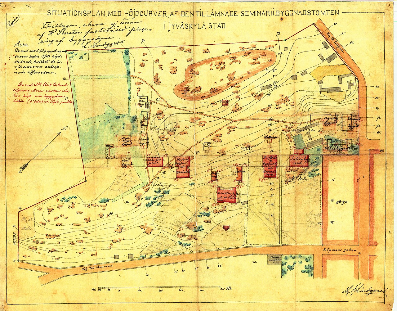
| Title |
Situationsplan : med höjocurver, af den tillämnade seminariibyggnadstomten i Jyväskylä stad |
|||||||||||||||||||
| Description |
Suomi: Ludvig Isak Lindqvistin laatima asemakaavakartta Jyväskylän seminaarista |
|||||||||||||||||||
| Date | ||||||||||||||||||||
| Source | https://jyx.jyu.fi/dspace/handle/123456789/6908 | |||||||||||||||||||
| Creator |
|
|||||||||||||||||||
| Georeferencing | If inappropriate please set warp_status = skip to hide. | |||||||||||||||||||
Licensing
[edit].jpg&action=edit§ion=2)
|
This work is in the public domain in its country of origin and other countries and areas where the copyright term is the author's life plus 70 years or fewer. This work is in the public domain in the United States because it was published (or registered with the U.S. Copyright Office) before January 1, 1929. | |
| This file has been identified as being free of known restrictions under copyright law, including all related and neighboring rights. | |
File history
Click on a date/time to view the file as it appeared at that time.
| Date/Time | Thumbnail | Dimensions | User | Comment | |
|---|---|---|---|---|---|
| current | 12:53, 28 September 2017 | | 6,791 × 5,315 (5.82 MB) | StultuS (talk | contribs) | User created page with UploadWizard |
You cannot overwrite this file.
File usage on Commons
There are no pages that use this file.
File usage on other wikis
The following other wikis use this file:
- Usage on fi.wikipedia.org
.jpg&oldid=719347167)