File:Map of Sealand.png

Original file (1,024 × 1,047 pixels, file size: 36 KB, MIME type: image/png)
Captions
Captions
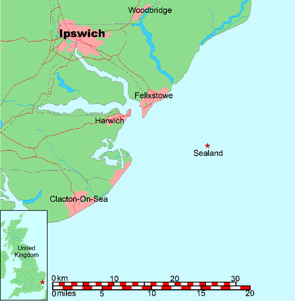
Map of Sealand
This is a map of the coast of England near Ipswich, showing the location of Sealand. See also Image:Map of Sealand with territorial waters.png for a map including the boundaries of the territorial waters of the United Kingdom.
- A vector graphic file for the map without the territorial waters can be found at Image:Map of Sealand with territorial waters.svg
- A PNG graphic file for the map without the territorial waters can be found at Image:Map of Sealand with territorial waters.png
- The OpenOffice.org source file can be found at Image:Map of Sealand with territorial waters.sxd
Map generated by DEMIS World Map Server[dead link] and edited by Chris 73
| Licensing:
This image was created by Chris 73. The image is licensed under a dual license; please choose either of the two licenses below as desired. Attribution to Wikipedia or another project of the Wikimedia foundation is required for both licenses if the image is used outside of projects of the Wikimedia foundation. Attribution to me is not required.
This file is licensed under the Creative Commons Attribution-Share Alike 3.0 Unported license. Attribution: Chris 73 / Wikimedia Commons
"I want to use the image. How do I do that?" You can use this image freely for any purpose, including commercial use, provided that you license it under one of the above licenses. My suggestion is to use the following text:
For privacy reasons please use only "Chris 73" as author. If necessary, please translate the text in your language. For electronic use please include the links in the text as shown, for printed use please print the text as shown. If you use the image I would appreciate it if you would let me know on my talk page, but this is not required as long as you follow one of the above licenses. |

File history
Click on a date/time to view the file as it appeared at that time.
| Date/Time | Thumbnail | Dimensions | User | Comment | |
|---|---|---|---|---|---|
| current | 10:00, 26 January 2005 | | 1,024 × 1,047 (36 KB) | Chris 73 (talk | contribs) | |
| 09:28, 26 January 2005 |  | 1,024 × 1,048 (36 KB) | Chris 73 (talk | contribs) | changed scale and also stretched a bit | |
| 05:24, 26 January 2005 |  | 998 × 733 (32 KB) | Chris 73 (talk | contribs) | Map of Sealand |
You cannot overwrite this file.
File usage on Commons
The following 3 pages use this file:
File usage on other wikis
The following other wikis use this file:
- Usage on be-tarask.wikipedia.org
- Usage on bg.wikipedia.org
- Usage on ca.wikipedia.org
- Usage on cy.wikipedia.org
- Usage on da.wikipedia.org
- Usage on et.wikipedia.org
- Usage on gl.wikipedia.org
- Usage on is.wikipedia.org
- Usage on it.wikipedia.org
- Usage on ja.wikivoyage.org
- Usage on lv.wikipedia.org
- Usage on ms.wikipedia.org
- Usage on nn.wikipedia.org
- Usage on no.wikipedia.org
- Usage on scn.wikipedia.org
- Usage on sv.wikipedia.org
- Usage on uk.wikipedia.org
- Usage on www.wikidata.org