File:Map of Saint Peterburg Governorate 1770.jpg
Jump to navigation
Jump to search
Size of this preview: 748 × 600 pixels. Other resolutions: 299 × 240 pixels | 599 × 480 pixels | 958 × 768 pixels | 1,277 × 1,024 pixels | 2,555 × 2,048 pixels | 6,925 × 5,552 pixels.
Original file (6,925 × 5,552 pixels, file size: 11.44 MB, MIME type: image/jpeg)
Captions
Captions
Add a one-line explanation of what this file represents
Summary
[edit]
| Description |
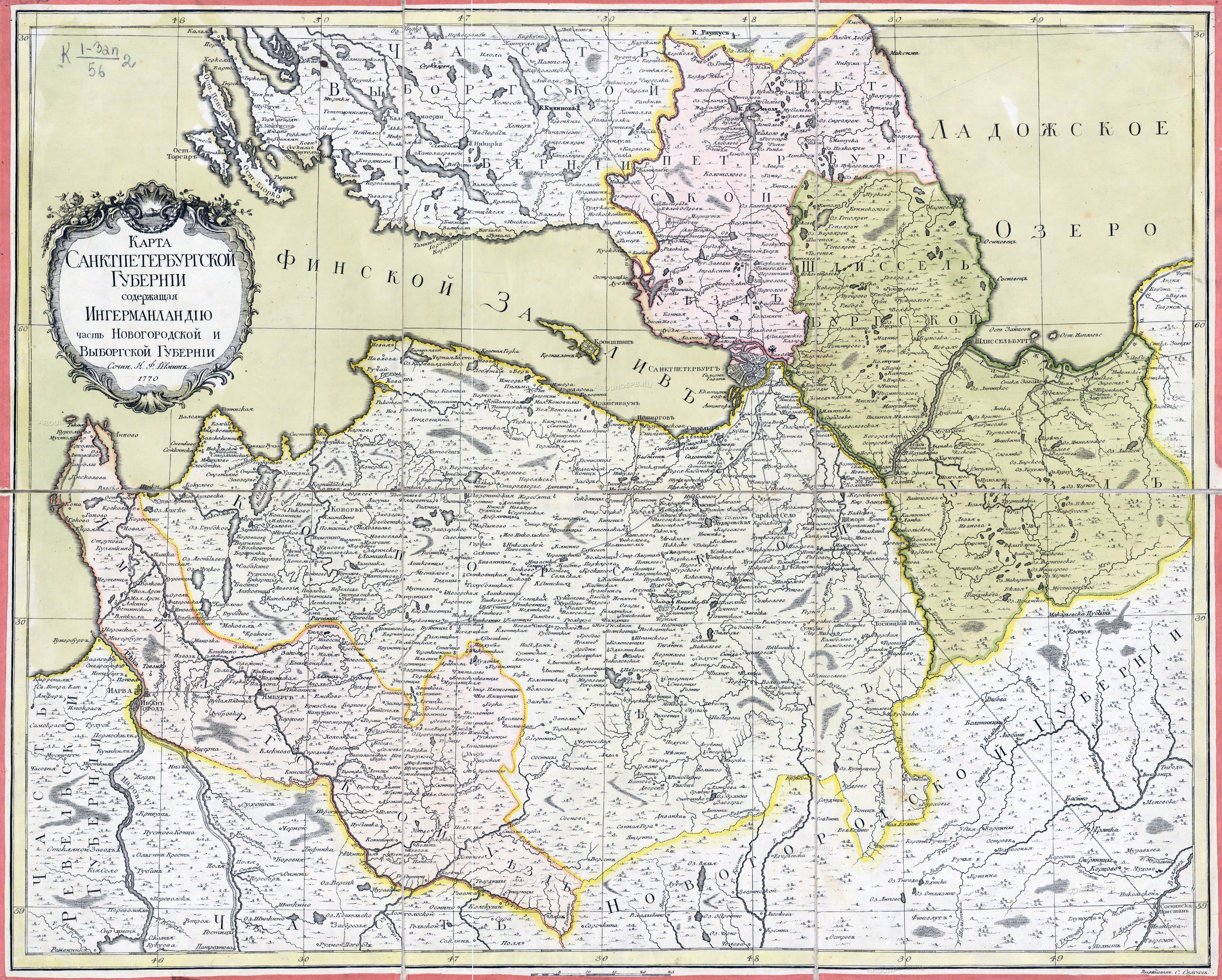
Eesti: Peterburi kubermangu kaart 1770 English: Map of Saint Peterburg Governorate 1770 Русский: Карта Санкт-Петербургской губернии. 1770 год.
содержащая Ингерманландию, часть Новгородской и Выборгской губернии сочин. Я.Ф.Шмит |
| Date | |
| Source | http://www.aroundspb.ru/karty/157/sg_1770_schmidt.html |
| Author | Jacob-Friedrich Schmidt (?- 1786) |
Licensing
[edit]
|
This work is in the public domain in its country of origin and other countries and areas where the copyright term is the author's life plus 100 years or fewer. | |
| This file has been identified as being free of known restrictions under copyright law, including all related and neighboring rights. | |
File history
Click on a date/time to view the file as it appeared at that time.
| Date/Time | Thumbnail | Dimensions | User | Comment | |
|---|---|---|---|---|---|
| current | 08:34, 11 May 2012 | | 6,925 × 5,552 (11.44 MB) | NOSSER (talk | contribs) |
You cannot overwrite this file.
File usage on Commons
There are no pages that use this file.
File usage on other wikis
The following other wikis use this file:
- Usage on da.wikipedia.org
- Usage on et.wikipedia.org
- Usage on www.wikidata.org