File:Map of Russia - Southern Federal District (2018 composition).svg
Jump to navigation
Jump to search

Size of this PNG preview of this SVG file: 800 × 462 pixels. Other resolutions: 320 × 185 pixels | 640 × 369 pixels | 1,024 × 591 pixels | 1,280 × 738 pixels | 2,560 × 1,477 pixels | 1,092 × 630 pixels.
Original file (SVG file, nominally 1,092 × 630 pixels, file size: 61 KB)
Captions
Captions
Add a one-line explanation of what this file represents
Summary
[edit].svg&action=edit§ion=1)
| Description |
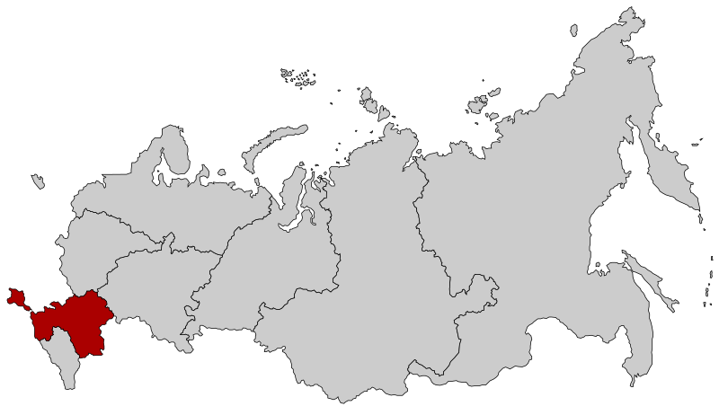
Русский: Южный федеральный округ с 28 июля 2016 года (с Крымом) с обновлением границы Дальневосточного и Сибирского ФО |
| Date | |
| Source |
This file was derived from: |
| Author |
|
.svg)
.svg)
| This is a retouched picture, which means that it has been digitally altered from its original version. Modifications: Far Eastern-Siberian border update as of November 2018. The original can be viewed here: Map of Russia - Far Eastern Federal District (2018 composition).svg:
|
Licensing
[edit].svg&action=edit§ion=2)
This file is licensed under the Creative Commons Attribution-Share Alike 2.5 Generic license.
- You are free:
- to share – to copy, distribute and transmit the work
- to remix – to adapt the work
- Under the following conditions:
- attribution – You must give appropriate credit, provide a link to the license, and indicate if changes were made. You may do so in any reasonable manner, but not in any way that suggests the licensor endorses you or your use.
- share alike – If you remix, transform, or build upon the material, you must distribute your contributions under the same or compatible license as the original.
Original upload log
[edit].svg&action=edit§ion=3)
This image is a derivative work of the following images:
- File:Map of Russia - Southern Federal District (with Crimea).svg licensed with Cc-by-sa-2.5
- 2016-07-28T15:56:06Z Seryo93 1092x630 (97541 Bytes) User created page with UploadWizard
- File:Map of Russia - Far Eastern Federal District (2018 composition).svg licensed with Cc-by-sa-2.5
- 2018-11-04T19:15:28Z Seryo93 1092x630 (62312 Bytes) == {{int:filedesc}} == {{Information |Description={{en|Map Russia highlighting the '''Far Eastern [[:en:Federal districts of Russia|Federal district]]''' as of 2018-11-03.}} {{es|Ubicación del Distrito Federal de Lejano Orie
Uploaded with derivativeFX
File history
Click on a date/time to view the file as it appeared at that time.
| Date/Time | Thumbnail | Dimensions | User | Comment | |
|---|---|---|---|---|---|
| current | 20:02, 21 November 2018 | | 1,092 × 630 (61 KB) | Seryo93 (talk | contribs) | == {{int:filedesc}} == {{Information |Description={{en|Map Russia highlighting the Southern Federal districts as of 2018-11-03.}} {{es|Ubicación del Distrito Federal Sur en la Federación Rusa}} {{Ru|Южный федеральный округ}} |Source={{Derived from|Map of Russia - Southern Federal District.svg|Map of Russia - Far Eastern Federal District (2018 composition).svg|display=50}} |Date=2018-11-21 20:01 (UTC) |Author= * [[:File:Map of Russia - Southern Federal Distr... |
You cannot overwrite this file.
File usage on Commons
The following 2 pages use this file:
.svg)
File usage on other wikis
The following other wikis use this file:
- Usage on cs.wikipedia.org
- Usage on en.wikinews.org
- Usage on fr.wikipedia.org
- Usage on it.wikipedia.org
- Usage on no.wikipedia.org
- Usage on ru.wikipedia.org
- Usage on zh-min-nan.wikipedia.org
.svg&oldid=725761197)