File:Map of Red Mountain and the mining region of San Juan, Ouray, San Miguel and Dolores Counties, Colo. - DPLA - 525884f28513a3b4ba0fd700d4636ba0.jpg
Jump to navigation
Jump to search

Size of this preview: 679 × 600 pixels. Other resolutions: 272 × 240 pixels | 543 × 480 pixels | 870 × 768 pixels | 1,159 × 1,024 pixels | 2,319 × 2,048 pixels | 7,000 × 6,183 pixels.
Original file (7,000 × 6,183 pixels, file size: 9.55 MB, MIME type: image/jpeg)
Captions
Captions
Add a one-line explanation of what this file represents
Summary
[edit]This file was uploaded by the Digital Public Library of America, and the following item metadata was created by the contributing institution's staff.
Note: this data is being maintained by an automated bot, synced with the source data.
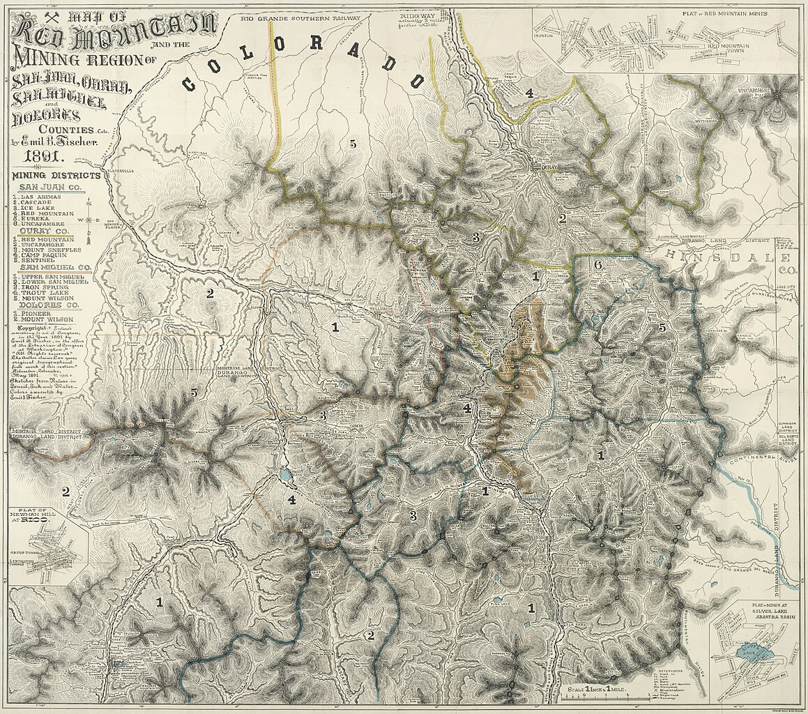
| Description | 1:63,360. 1 inch to 1 mile | ||||||||||||||||||||
| Title | Map of Red Mountain and the mining region of San Juan, Ouray, San Miguel and Dolores Counties, Colo., Red Mountain and the mining region of San Juan, Ouray, San Miguel and Dolores Counties, Colorado | ||||||||||||||||||||
| Institution |
|
||||||||||||||||||||
| Subject | |||||||||||||||||||||
| Source |
Plains to Peaks Collective |
||||||||||||||||||||
| Author |
Fischer, Emil B |
||||||||||||||||||||
| Permission (Reusing this file) |
Copyright determination made by Denver Public Library (Q69470198) using RightsStatements.org
|
||||||||||||||||||||
| Partnership |
|
||||||||||||||||||||


File history
Click on a date/time to view the file as it appeared at that time.
| Date/Time | Thumbnail | Dimensions | User | Comment | |
|---|---|---|---|---|---|
| current | 13:03, 18 December 2020 | | 7,000 × 6,183 (9.55 MB) | DPLA bot (talk | contribs) | Uploading DPLA ID 525884f28513a3b4ba0fd700d4636ba0 |
You cannot overwrite this file.
File usage on Commons
There are no pages that use this file.