File:Map of Quebec-fr.png
Jump to navigation
Jump to search
Size of this preview: 569 × 600 pixels. Other resolutions: 228 × 240 pixels | 455 × 480 pixels.
Original file (800 × 843 pixels, file size: 1.02 MB, MIME type: image/png)
Captions
Captions
Add a one-line explanation of what this file represents
| Description |
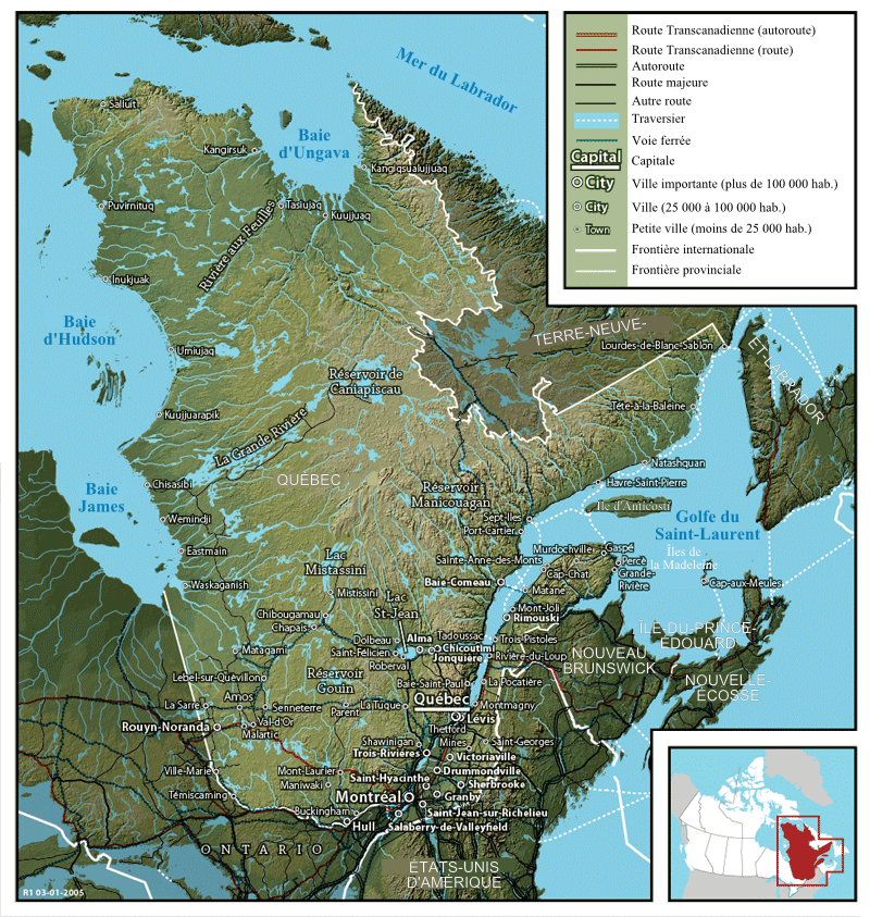
Français : Carte du Québec English: Map of Québec |
||
| Date | 6 August 2007 (upload date) | ||
| Source | Image:Map of Quebec.png created by John Fowler, who released the image to the public domain. | ||
| Author | Modification by historicair 07:47, 6 August 2007 (UTC) / Translation by Boréal | ||
| Permission (Reusing this file) |
|
||
| Other versions |
Français : Version anglaise Image:Map of Quebec.png English: English version Image:Map of Quebec.png |
File history
Click on a date/time to view the file as it appeared at that time.
| Date/Time | Thumbnail | Dimensions | User | Comment | |
|---|---|---|---|---|---|
| current | 07:47, 6 August 2007 | | 800 × 843 (1.02 MB) | Historicair (talk | contribs) | {{Information |Description={{fr}}Carte du Québec (1941) {{en}}Map of Québec |Source=Image:Map of Quebec.png created by John Fowler, who released the image to the public domain. |Date=06/08/2007 |Author=Modification by ~~~~ |
You cannot overwrite this file.
File usage on Commons
The following page uses this file:
File usage on other wikis
The following other wikis use this file:
- Usage on de.wikipedia.org
- Usage on fr.wikipedia.org
- Usage on hr.wikipedia.org
- Usage on mg.wikipedia.org
- Usage on pcd.wikipedia.org
- Usage on sr.wikipedia.org
- Usage on sw.wikipedia.org