File:Map of Public Surveys In Colorado Territory - NARA - 23812218.jpg
Jump to navigation
Jump to search
Size of this preview: 702 × 599 pixels. Other resolutions: 281 × 240 pixels | 562 × 480 pixels | 900 × 768 pixels | 1,199 × 1,024 pixels | 2,399 × 2,048 pixels | 6,880 × 5,874 pixels.
Original file (6,880 × 5,874 pixels, file size: 3.67 MB, MIME type: image/jpeg)
Captions
Captions
Add a one-line explanation of what this file represents
Summary
[edit]
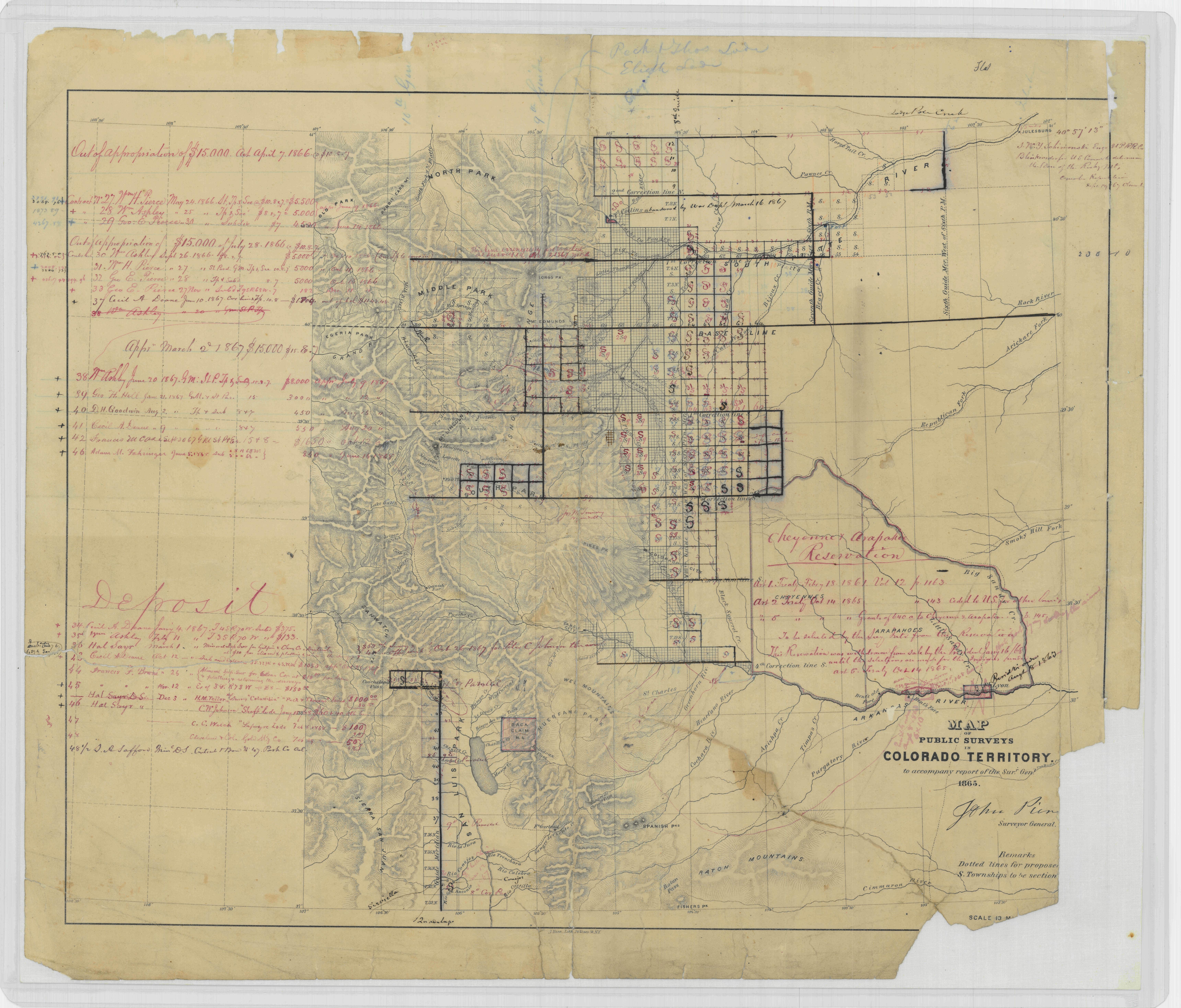
| Map of Public Surveys In Colorado Territory
( |
|||||||||||||||||||||||||||
|---|---|---|---|---|---|---|---|---|---|---|---|---|---|---|---|---|---|---|---|---|---|---|---|---|---|---|---|
| Author |
Unknown author or not provided |
||||||||||||||||||||||||||
| Record creator | Department of the Interior. General Land Office. 1849-7/16/1946 | ||||||||||||||||||||||||||
| Title |
Map of Public Surveys In Colorado Territory |
||||||||||||||||||||||||||
| Date | 1865 | ||||||||||||||||||||||||||
| Collection |
|
||||||||||||||||||||||||||
| Record ID |
|
||||||||||||||||||||||||||
| Source | U.S. National Archives and Records Administration | ||||||||||||||||||||||||||
| Other versions |
Please do not overwrite this file: any restoration work should be uploaded with a new name and linked in this page's "other versions=" parameter, so that this file represents the exact file found in the NARA catalog record to which it links. The metadata on this page was imported directly from NARA's catalog record; additional descriptive text may be added by Wikimedians to the template below with the "description=" parameter, but please do not modify the other fields. |
||||||||||||||||||||||||||
Licensing
[edit]
This file was provided to Wikimedia Commons by the National Archives and Records Administration as part of a cooperation project. The National Archives and Records Administration provides images depicting American and global history which are public domain or licensed under a free license.
|
| This image is a work of a Bureau of Land Management* employee, taken or made as part of that person's official duties. As a work of the U.S. federal government, the image is in the public domain in the United States. *or predecessor organization |
File history
Click on a date/time to view the file as it appeared at that time.
| Date/Time | Thumbnail | Dimensions | User | Comment | |
|---|---|---|---|---|---|
| current | 15:35, 25 July 2019 | | 6,880 × 5,874 (3.67 MB) | US National Archives bot (talk | contribs) | Bot-assisted upload of US National Archives Identifer 23812218. |
You cannot overwrite this file.
File usage on Commons
The following page uses this file: