File:Map of Orasul Stalin.jpg
Jump to navigation
Jump to search

Size of this preview: 663 × 600 pixels. Other resolutions: 265 × 240 pixels | 530 × 480 pixels | 849 × 768 pixels | 1,132 × 1,024 pixels | 2,471 × 2,236 pixels.
Original file (2,471 × 2,236 pixels, file size: 879 KB, MIME type: image/jpeg)
Captions
Captions
Add a one-line explanation of what this file represents
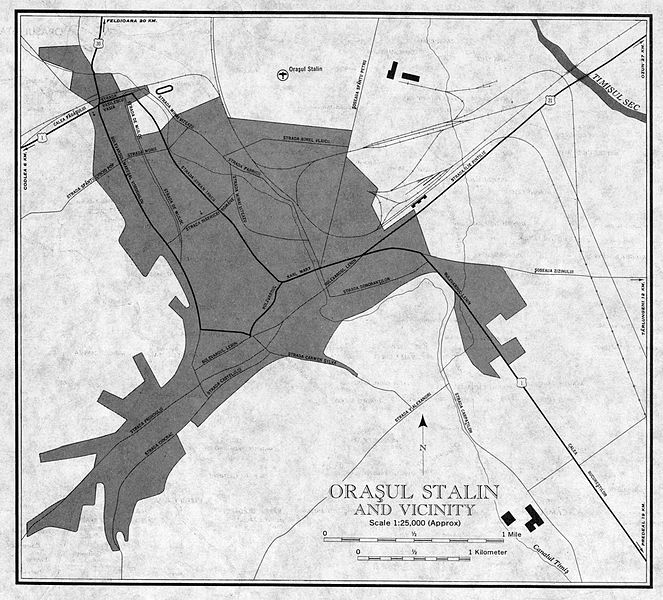
| Description | Oraşul Stalin (a.k.a. Braşov) and vicinity |
| Date | |
| Source | University of Texas Libraries |
| Author | US Army Map Service, Corps of Engineers |
This image or file is a work of a U.S. Army Corps of Engineers soldier or employee, taken or made as part of that person's official duties. As a work of the U.S. federal government, the image is in the public domain.
|
File history
Click on a date/time to view the file as it appeared at that time.
| Date/Time | Thumbnail | Dimensions | User | Comment | |
|---|---|---|---|---|---|
| current | 00:33, 11 November 2009 | | 2,471 × 2,236 (879 KB) | Alex:D (talk | contribs) | {{Information |Description= ''Oraşul Stalin'' (a.k.a. Braşov) and vicinity |Source= [http://www.lib.utexas.edu/maps/ams/western_europe/ University of Texas Libraries] |Date= 1959 |Author= US Army Map Service, Corps of Engineers |Permission= |other_versi |
You cannot overwrite this file.
File usage on Commons
There are no pages that use this file.