File:Map of Mouth of Saco River, Maine Showing present condition of Breakwater and Bar with Plan and Location of proposed Improvements. - DPLA - d07fda523cbdb76696c430fbeb941da2.jpg
Jump to navigation
Jump to search

Size of this preview: 800 × 451 pixels. Other resolutions: 320 × 180 pixels | 640 × 361 pixels | 1,024 × 577 pixels | 1,280 × 721 pixels | 2,560 × 1,443 pixels | 12,975 × 7,312 pixels.
Original file (12,975 × 7,312 pixels, file size: 4.2 MB, MIME type: image/jpeg)
Captions
Captions
Add a one-line explanation of what this file represents
| Warning | The original file is very high-resolution. It might not load properly or could cause your browser to freeze when opened at full size. |
|---|
Summary
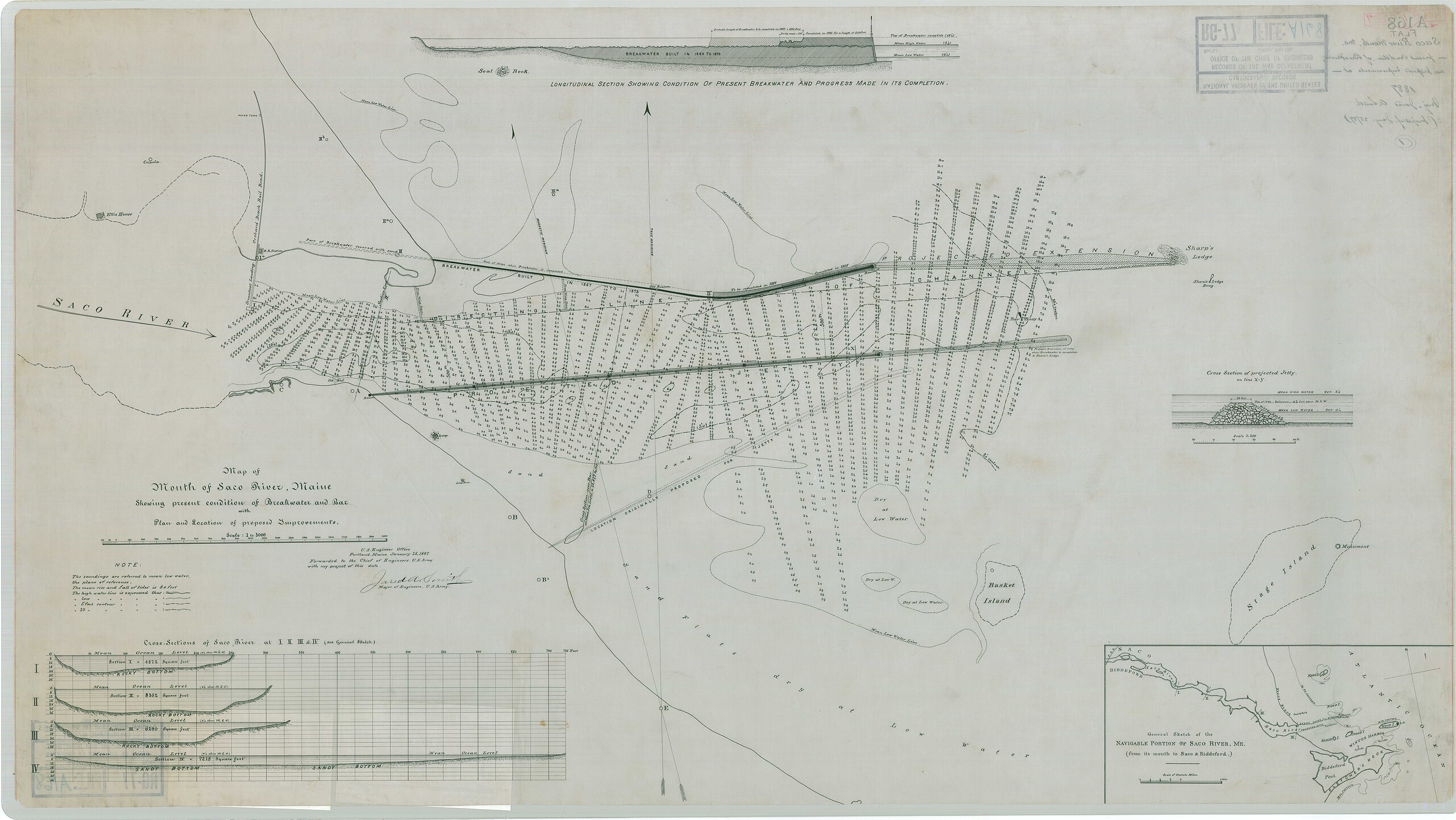
[edit]| Map of Mouth of Saco River, Maine Showing present condition of Breakwater and Bar with Plan and Location of proposed Improvements.
( |
||||||||||||||
|---|---|---|---|---|---|---|---|---|---|---|---|---|---|---|
| Creator | War Department. Office of the Chief of Engineers. 1818-9/18/1947 | |||||||||||||
| Title |
Map of Mouth of Saco River, Maine Showing present condition of Breakwater and Bar with Plan and Location of proposed Improvements. |
|||||||||||||
| Date | 25 January 1887 | |||||||||||||
| Collection |
|
|||||||||||||
| Source/Photographer |
|
|||||||||||||
| Permission (Reusing this file) |
|
|||||||||||||
| Standardized rights statement |
|
|||||||||||||


File history
Click on a date/time to view the file as it appeared at that time.
| Date/Time | Thumbnail | Dimensions | User | Comment | |
|---|---|---|---|---|---|
| current | 20:18, 25 November 2020 | | 12,975 × 7,312 (4.2 MB) | DPLA bot (talk | contribs) | Uploading DPLA ID d07fda523cbdb76696c430fbeb941da2 |
You cannot overwrite this file.
File usage on Commons
The following page uses this file: