File:Map of Montreal (1758) by Thomas Jefferys.jpg

Original file (8,251 × 5,346 pixels, file size: 9.94 MB, MIME type: image/jpeg)
Captions
Captions
Summary
[edit]_by_Thomas_Jefferys.jpg&action=edit§ion=1)
| Description |
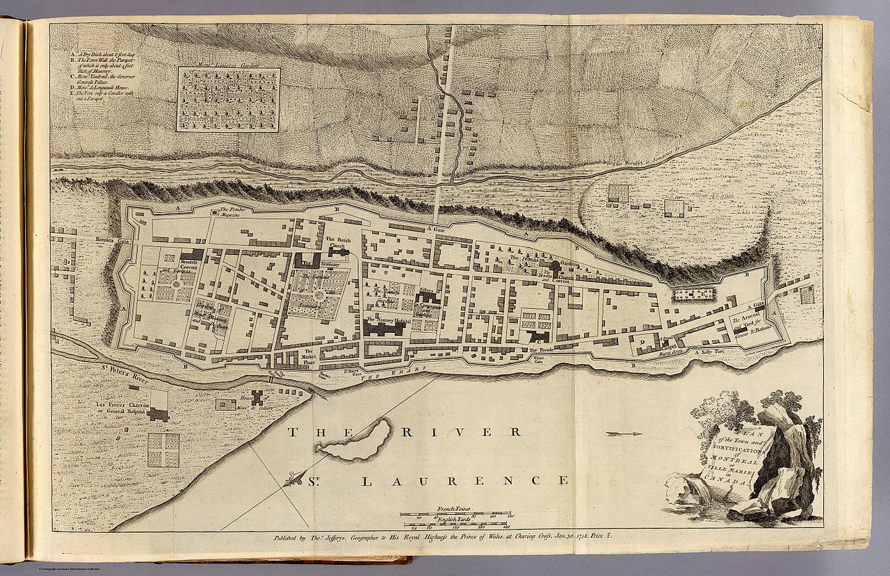
Français : Plan de Montréal en 1758, par Thomas Jefferys. |
| Date | |
| Source | http://www.davidrumsey.com/luna/servlet/detail/RUMSEY~8~1~29568~1141031:Plan-of-the-town-and-fortifications# |
| Author |
Jefferys, Thomas Date:1758 Publication Author:Jefferys, Thomas Pub Date:1760 |
Jefferys, Thomas Date: 1758 Short Title: Montreal or Ville Marie. Publisher: Thomas Jefferys Publisher Location: London Type: Book Map Obj Height cm: 34 Obj Width cm: 51 Scale 1: 3,300 Note: Engraved map. Shows buildings, fields, etc. Oriented with north toward upper right. Reference: Phillips. Maps of America, p. 450; Cf. LC Maps of North America, 619. State/Province: Quebec City: Montreal (Quebec) Full Title: Plan of the town and fortifications of Montreal or Ville Marie in Canada. Published by Thos. Jefferys, Geographer to His Royal Highness the Prince of Wales at Charing Cross, Jan 30, 1758. Price 2s. (1760) List No: 4796.003 Page No: (pt. 1, opp. p. 12) Series No: 5 Publication Author: Jefferys, Thomas Pub Date: 1760 Pub Title: The natural and civil history of the French dominions in North and South America. Giving a particular account of the climate, soil, minerals, animals, vegetables, manufactures, trade, commerce, and languages ... Illustrated by maps and plans of the principal places, collected from the best authorities, and engraved by T. Jefferys, Geographer to his Royal Highness the Prince of Wales. Part I. Containing a description of Canada and Louisiana. London, Printed for Thomas Jefferys at Charing-Cross. MDCCLX. Pub Reference: Howes J83; Streeter 128; Sabin 35964; P-Maps (lists all 18 maps); Stevens and Tree 27(b), 51(a), 66 (b); Clark I:263; Ristow p25-28 (Samuel Holland). Pub Note: See note field above. Pub List No: 4796.000 Pub Type: Geography Book Pub Maps: 18 Pub Height cm: 36 Pub Width cm: 23 Image No: 4796003 Download 1: Full Image Download… Download 2: GeoViewer for JP2 a… Collection: Rumsey Collection
| Thomas Jefferys
(1719–1771) |
|||
|---|---|---|---|
| Alternative names |
Thomas Gefferys, Thomas Jefferies, Thomas Jeffreys | ||
| Description | English cartographer and geographer | ||
| Date of birth/death | circa 1719 |
20 November 1771 | |
| Location of birth/death | England | London | |
| Work location | |||
| Authority file | |||
Licensing
[edit]_by_Thomas_Jefferys.jpg&action=edit§ion=2)
|
This work is in the public domain in its country of origin and other countries and areas where the copyright term is the author's life plus 70 years or fewer. This work is in the public domain in the United States because it was published (or registered with the U.S. Copyright Office) before January 1, 1929. | |
| This file has been identified as being free of known restrictions under copyright law, including all related and neighboring rights. | |
File history
Click on a date/time to view the file as it appeared at that time.
| Date/Time | Thumbnail | Dimensions | User | Comment | |
|---|---|---|---|---|---|
| current | 02:23, 5 December 2016 | | 8,251 × 5,346 (9.94 MB) | Pierre5018 (talk | contribs) | User created page with UploadWizard |
You cannot overwrite this file.
File usage on Commons
There are no pages that use this file.
File usage on other wikis
The following other wikis use this file:
- Usage on fr.wikipedia.org
_by_Thomas_Jefferys.jpg&oldid=830785432)