File:Map of Monroe County, Michigan, 1859.jpg
Jump to navigation
Jump to search

Size of this preview: 800 × 576 pixels. Other resolutions: 320 × 230 pixels | 640 × 461 pixels | 1,024 × 737 pixels | 1,280 × 922 pixels | 2,560 × 1,843 pixels | 18,899 × 13,606 pixels.
Original file (18,899 × 13,606 pixels, file size: 48.07 MB, MIME type: image/jpeg)
Captions
Captions
Add a one-line explanation of what this file represents
| Warning | The original file is very high-resolution. It might not load properly or could cause your browser to freeze when opened at full size. |
|---|
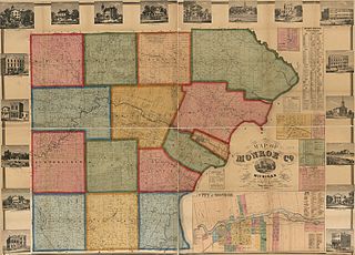
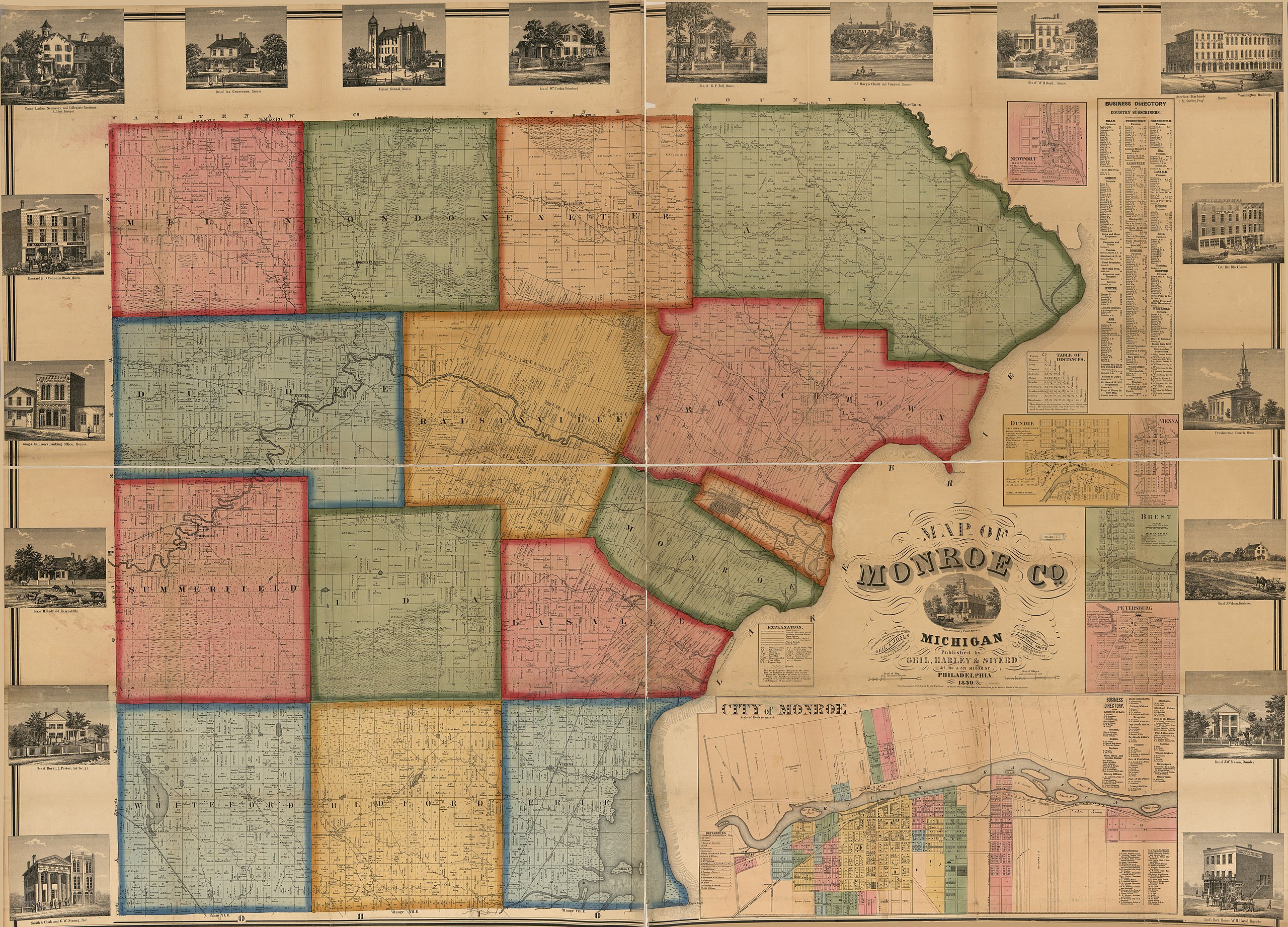
| Description | Map of Monroe County, Michigan | |||||||||||||||||||||||
| Date | ||||||||||||||||||||||||
| Source |
|
|||||||||||||||||||||||
| Author | Geil & Jones | |||||||||||||||||||||||
| Permission (Reusing this file) |
|
|||||||||||||||||||||||
| Other versions | https://www.loc.gov/item/2012593018 | |||||||||||||||||||||||


File history
Click on a date/time to view the file as it appeared at that time.
| Date/Time | Thumbnail | Dimensions | User | Comment | |
|---|---|---|---|---|---|
| current | 22:06, 26 February 2014 | | 18,899 × 13,606 (48.07 MB) | Scewing (talk | contribs) | {{Information |Description=Map of Monroe County, Michigan |Source={{Institution:Library of Congress}} |Date=1859 |Author=Geil & Jones |Permission={{PD-US}} |other_versions=http://www.loc.gov/item/2012593018 }} Category:1859 maps [[Category:Maps of... |
You cannot overwrite this file.
File usage on Commons
There are no pages that use this file.