File:Map of Michigan highlighting Manistee County.svg
Jump to navigation
Jump to search

Size of this PNG preview of this SVG file: 512 × 600 pixels. Other resolutions: 205 × 240 pixels | 410 × 480 pixels | 655 × 768 pixels | 874 × 1,024 pixels | 1,748 × 2,048 pixels | 962 × 1,127 pixels.
Original file (SVG file, nominally 962 × 1,127 pixels, file size: 138 KB)
Captions
Captions
Add a one-line explanation of what this file represents
Summary
[edit]
| Description |
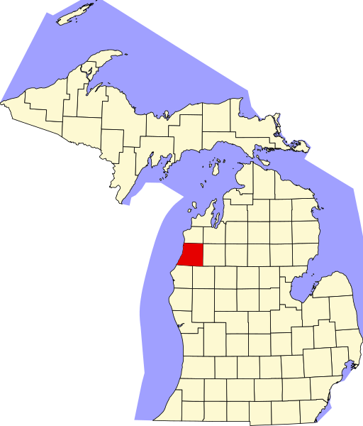
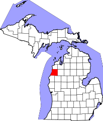
English: This is a locator map showing Manistee County in Michigan. For more information, see Commons:United States county locator maps. |
| Date | |
| Source |
Own work: English: The maps use data from nationalatlas.gov, specifically countyp020.tar.gz on the Raw Data Download page. The maps also use state outline data from statesp020.tar.gz. The Florida maps use hydrogm020.tar.gz to display Lake Okeechobee. |
| Author | David Benbennick |
Licensing
[edit]
| I, the copyright holder of this work, release this work into the public domain. This applies worldwide. In some countries this may not be legally possible; if so: I grant anyone the right to use this work for any purpose, without any conditions, unless such conditions are required by law. |
File history
Click on a date/time to view the file as it appeared at that time.
| Date/Time | Thumbnail | Dimensions | User | Comment | |
|---|---|---|---|---|---|
| current | 10:20, 25 June 2024 | | 962 × 1,127 (138 KB) | Nux (talk | contribs) | fix rendering (remove clipping) |
| 12:56, 12 February 2006 |  | 6,256 × 7,325 (205 KB) | David Benbennick (talk | contribs) | {{subst:User:Dbenbenn/clm|county=Manistee County|state=Michigan|type=county}} |
You cannot overwrite this file.
File usage on Commons
The following 2 pages use this file:
File usage on other wikis
The following other wikis use this file:
- Usage on ar.wikipedia.org
- مانيستي
- بلدة أركاديا (مقاطعة مانيستي)
- بلدة بير ليك (مقاطعة مانيستي)
- بلدة براونستاون تشارتر (ميشيغان)
- بلدة كليون (ميشيغان)
- بلدة ديكسون (ميشيغان)
- بلدة فيلير تشارتر (ميشيغان)
- بلدة مانيستي (ميشيغان)
- بلدة مابل غروف (مقاطعة مانيستي)
- بلدة ماريلا (ميشيغان)
- بلدة نورمان (ميشيغان)
- بلدة ونكاما (ميشيغان)
- بلدة بليزانتون (ميشيغان)
- بلدة سبرينغديل (ميشيغان)
- بلدة ستروناتش (ميشيغان)
- إيستليك (ميشيغان)
- أونكاما (ميشيغان)
- بير ليك (ميشيغان)
- كاليفا (ميشيغان)
- كوبيميش (ميشيغان)
- مقاطعة مانيستي (ميشيغان)
- قالب:مقاطعة مانيستي (ميشيغان)
- Usage on bg.wikipedia.org
- Usage on bpy.wikipedia.org
- Usage on cdo.wikipedia.org
- Usage on ceb.wikipedia.org
- Usage on cs.wikipedia.org
- Usage on cy.wikipedia.org
- Usage on de.wikipedia.org
- Usage on en.wikipedia.org
- List of counties in Michigan
- Manistee County, Michigan
- Bear Lake, Michigan
- Brown Township, Michigan
- Cleon Township, Michigan
- Copemish, Michigan
- Dickson Township, Michigan
- Eastlake, Michigan
- Filer Charter Township, Michigan
- Kaleva, Michigan
- Manistee, Michigan
- Manistee Township, Michigan
- Maple Grove Township, Manistee County, Michigan
- Marilla Township, Michigan
- Norman Township, Michigan
- Onekama, Michigan
- Onekama Township, Michigan
View more global usage of this file.