File:Map of Michigan highlighting Cheboygan County.svg
Jump to navigation
Jump to search

Size of this PNG preview of this SVG file: 512 × 600 pixels. Other resolutions: 205 × 240 pixels | 410 × 480 pixels | 655 × 768 pixels | 874 × 1,024 pixels | 1,748 × 2,048 pixels | 962 × 1,127 pixels.
Original file (SVG file, nominally 962 × 1,127 pixels, file size: 138 KB)
Captions
Captions
Add a one-line explanation of what this file represents
Summary
[edit]
| Description |
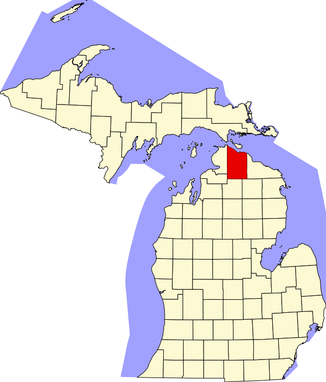
English: This is a locator map showing Cheboygan County in Michigan. For more information, see Commons:United States county locator maps. |
| Date | |
| Source |
Own work: English: The maps use data from nationalatlas.gov, specifically countyp020.tar.gz on the Raw Data Download page. The maps also use state outline data from statesp020.tar.gz. The Florida maps use hydrogm020.tar.gz to display Lake Okeechobee. |
| Author | David Benbennick |
Licensing
[edit]
| I, the copyright holder of this work, release this work into the public domain. This applies worldwide. In some countries this may not be legally possible; if so: I grant anyone the right to use this work for any purpose, without any conditions, unless such conditions are required by law. |
File history
Click on a date/time to view the file as it appeared at that time.
| Date/Time | Thumbnail | Dimensions | User | Comment | |
|---|---|---|---|---|---|
| current | 10:12, 25 June 2024 | | 962 × 1,127 (138 KB) | Nux (talk | contribs) | fix rendering (remove clipping) |
| 12:52, 12 February 2006 |  | 6,256 × 7,325 (205 KB) | David Benbennick (talk | contribs) | {{subst:User:Dbenbenn/clm|county=Cheboygan County|state=Michigan|type=county}} |
You cannot overwrite this file.
File usage on Commons
The following 4 pages use this file:
File usage on other wikis
The following other wikis use this file:
- Usage on ar.wikipedia.org
- شيبوغن
- بلدة ألوها (ميشيغان)
- بلدة بياوغراند (ميشيغان)
- بلدة بنتون (مقاطعة شبوغن)
- بلدة بيرت (مقاطعة شبوغن)
- بلدة إليس (ميشيغان)
- بلدة فورست (مقاطعة شبوغن)
- بلدة غرانت (مقاطعة شبوغن)
- بلدة هيربون (ميشيغان)
- بلدة إنفيرنس (ميشيغان)
- بلدة كوهلر (ميشيغان)
- بلدة ماكيناو (ميشيغان)
- بلدة مينتور (مقاطعة شبوغن)
- بلدة موليت (ميشيغان)
- بلدة منرو (ميشيغان)
- بلدة نوندا (ميشيغان)
- بلدة توسكارورا (ميشيغان)
- بلدة ووكر (ميشيغان)
- بلدة ويفرلي (مقاطعة شبوغن)
- بلدة ويلموت (ميشيغان)
- ماكيناو سيتي (ميشيغان)
- ولفرين (ميشيغان)
- مقاطعة تشيبويجان (ميشيغان)
- قالب:مقاطعة تشيبويجان (ميشيغان)
- Usage on bg.wikipedia.org
- Usage on bpy.wikipedia.org
- Usage on cdo.wikipedia.org
- Usage on ceb.wikipedia.org
- Usage on cs.wikipedia.org
- Usage on cy.wikipedia.org
- Usage on de.wikipedia.org
- Usage on en.wikipedia.org
- List of counties in Michigan
- Cheboygan County, Michigan
- Aloha Township, Michigan
- Beaugrand Township, Michigan
- Benton Township, Cheboygan County, Michigan
- Burt Township, Cheboygan County, Michigan
- Cheboygan, Michigan
- Ellis Township, Michigan
- Forest Township, Cheboygan County, Michigan
- Grant Township, Cheboygan County, Michigan
- Hebron Township, Michigan
- Indian River, Michigan
- Inverness Township, Michigan
- Koehler Township, Michigan
- Mackinaw Township, Michigan
View more global usage of this file.