File:Map of Mars by Sciaparelli 1890.jpg
Jump to navigation
Jump to search
Size of this preview: 800 × 447 pixels. Other resolutions: 320 × 179 pixels | 640 × 358 pixels | 1,023 × 572 pixels.
Original file (1,023 × 572 pixels, file size: 505 KB, MIME type: image/jpeg)
Captions
Captions
Add a one-line explanation of what this file represents
| Description |
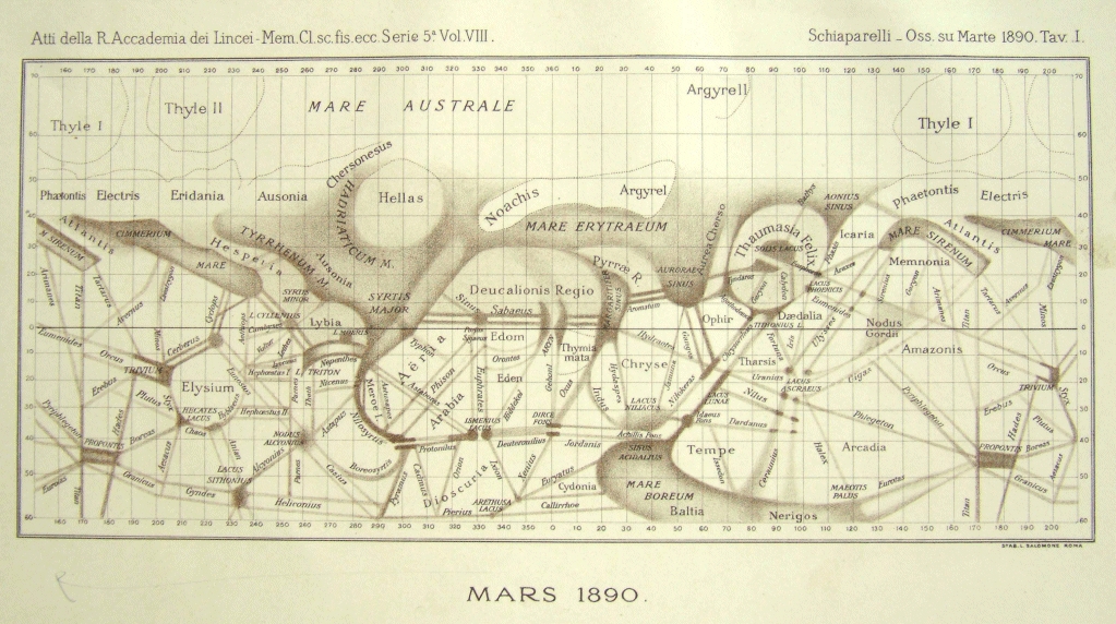
Ελληνικά: Χάρτης του πλανήτη Άρη σχεδιασμένος από τον ιταλό αστρονόμο Τζιοβάννι Σκιαπαρέλλι, σύμφωνα με παρατηρήσεις που έκανε το Μάρτιο του 1890. Ο Νότος είναι προς τα πάνω.
English: Atlas of Mars by Giovanni Schiaparelli, according to observations he made in March 1890. South is up. |
||||||||||||||||||||
| Date | |||||||||||||||||||||
| Source | [1] | ||||||||||||||||||||
| Author |
|
||||||||||||||||||||
| Permission (Reusing this file) |
|
||||||||||||||||||||

File history
Click on a date/time to view the file as it appeared at that time.
| Date/Time | Thumbnail | Dimensions | User | Comment | |
|---|---|---|---|---|---|
| current | 14:31, 23 September 2011 | | 1,023 × 572 (505 KB) | Badseed (talk | contribs) | better version |
| 13:37, 23 September 2011 |  | 800 × 431 (81 KB) | Badseed (talk | contribs) | {{Information |Description={{el|Χάρτης του πλανήτη Άρη σχεδιασμένος από τον ιταλό αστρονόμο Τζιοβάννι Σκιαπαρέλλι, σύμφωνα με � |
You cannot overwrite this file.
File usage on Commons
The following page uses this file:
File usage on other wikis
The following other wikis use this file:
- Usage on sc.wikipedia.org
- Usage on sr.wikipedia.org