File:Map of Macon, Ga. and vicinity. LOC 2006635265.jpg
Jump to navigation
Jump to search
Size of this preview: 590 × 600 pixels. Other resolutions: 236 × 240 pixels | 472 × 480 pixels | 756 × 768 pixels | 1,008 × 1,024 pixels | 2,015 × 2,048 pixels | 4,751 × 4,828 pixels.
Original file (4,751 × 4,828 pixels, file size: 2.32 MB, MIME type: image/jpeg)
Captions
Captions
Add a one-line explanation of what this file represents
Summary
[edit]| Description |
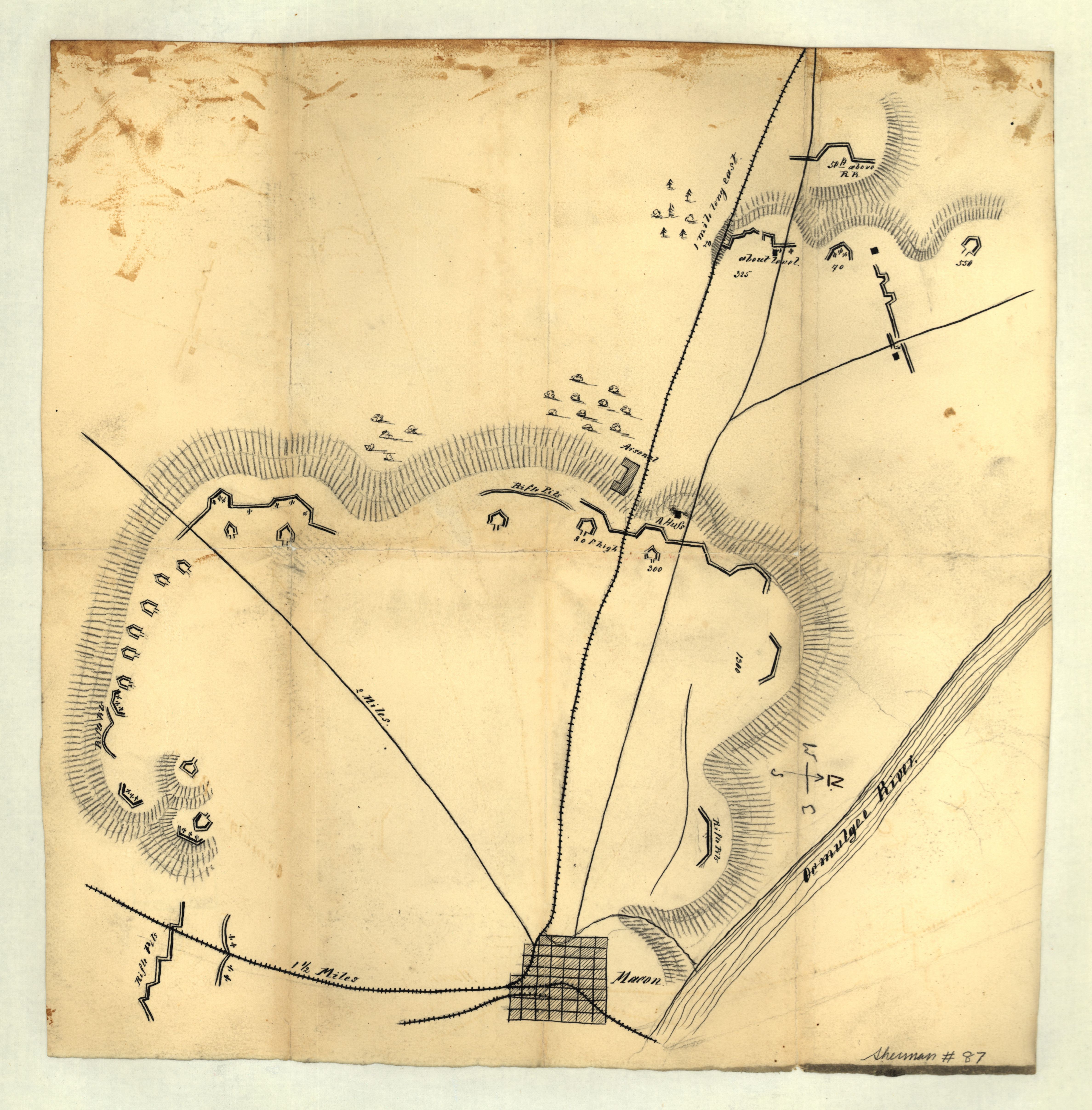
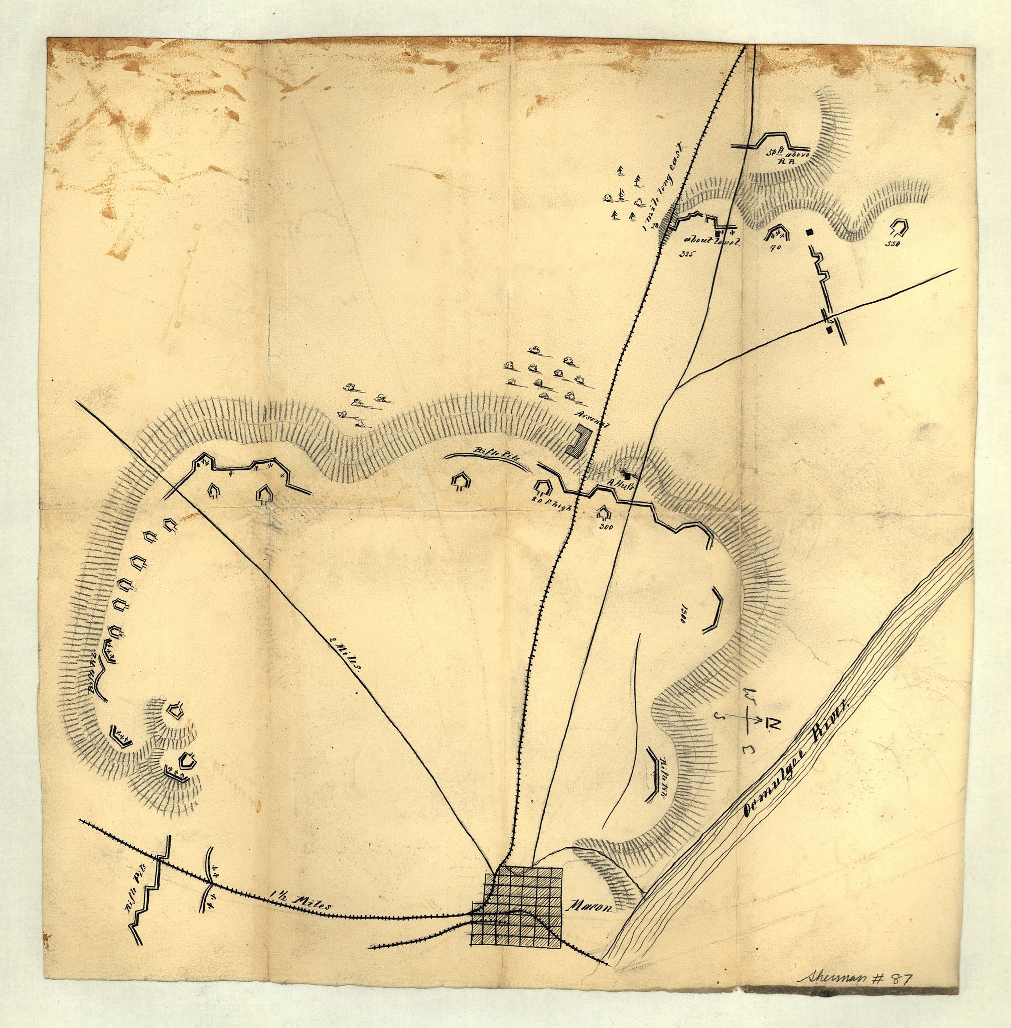
English: Shows fortifications in the Macon area. Title on verso. Oriented with north to the right. LC Civil War maps (2nd ed.), S87, 190 Available also through the Library of Congress Web site as a raster image. Pen and ink and pencil, separated along fold lines, mounted on cloth and laminated. Title on verso obscured by mounting. |
||
| Title | Map of Macon, Ga. and vicinity. | ||
| Shelf ID | G3924.M3S5 1864 .M2 | ||
| Date | |||
| Source | https://www.loc.gov/item/2006635265/ | ||
| Author | Unknown author | ||
| Permission (Reusing this file) |
|
||
| Other versions |
|
||
| Location | United States · Georgia · Macon | ||
| Part of | Military Battles And Campaigns · American Memory · Civil War Maps · Catalog · Geography And Map Division | ||
| Subject | Maps, Manuscript · Georgia · Civil War · United States · Macon (Ga.) · Macon · History |


Licensing
[edit]
|
This is a faithful photographic reproduction of a two-dimensional, public domain work of art. The work of art itself is in the public domain for the following reason:
The official position taken by the Wikimedia Foundation is that "faithful reproductions of two-dimensional public domain works of art are public domain".
This photographic reproduction is therefore also considered to be in the public domain in the United States. In other jurisdictions, re-use of this content may be restricted; see Reuse of PD-Art photographs for details. | ||||
File history
Click on a date/time to view the file as it appeared at that time.
| Date/Time | Thumbnail | Dimensions | User | Comment | |
|---|---|---|---|---|---|
| current | 15:48, 11 June 2018 | | 4,751 × 4,828 (2.32 MB) | Fæ (talk | contribs) | LOC Maps https://www.loc.gov/item/2006635265/ #12034 |
You cannot overwrite this file.
File usage on Commons
The following page uses this file: