File:Map of Lycoming County Pennsylvania School Districts.png
Jump to navigation
Jump to search
No higher resolution available.
Map_of_Lycoming_County_Pennsylvania_School_Districts.png (557 × 342 pixels, file size: 17 KB, MIME type: image/png)
Captions
Captions
Add a one-line explanation of what this file represents
Summary
[edit]
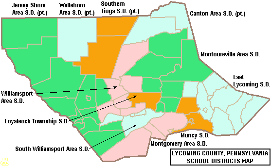
| Description | Map of Lycoming County, Pennsylvania, United States Public School Districts |
| Date | |
| Source | taken from US Census website [1] and modified by User:Ruhrfisch |
| Author | US Census, Ruhrfisch |
| Permission (Reusing this file) |
US Census / US Government work is public domain, my modifications licensed under the GNU Free Documentation License |
Licensing
[edit]

|
Permission is granted to copy, distribute and/or modify this document under the terms of the GNU Free Documentation License, Version 1.2 or any later version published by the Free Software Foundation; with no Invariant Sections, no Front-Cover Texts, and no Back-Cover Texts. A copy of the license is included in the section entitled GNU Free Documentation License. |
| This file is licensed under the Creative Commons Attribution-Share Alike 3.0 Unported license. | ||
| ||
| This licensing tag was added to this file as part of the GFDL licensing update. |
File history
Click on a date/time to view the file as it appeared at that time.
| Date/Time | Thumbnail | Dimensions | User | Comment | |
|---|---|---|---|---|---|
| current | 01:05, 30 May 2006 | | 557 × 342 (17 KB) | Ruhrfisch (talk | contribs) | == Summary == {{Information| |Description= Map of Lycoming County, Pennsylvania, United States Public School Districts |Source= taken from US Census website [http://factfinder.census.gov/] and modified by User:Ruhrfisch |Date= May 2006 |Author= US C |
| 15:00, 24 April 2006 |  | 557 × 342 (19 KB) | Ruhrfisch (talk | contribs) | {{Information| |Description= Map of Lycoming County, Pennsylvania, United States Public School Districts |Source= taken from US Census website [http://factfinder.census.gov/] and modified by User:Ruhrfisch |Date= April 2006 |Author= US Census, Ruhrf |
You cannot overwrite this file.
File usage on Commons
The following page uses this file:
File usage on other wikis
The following other wikis use this file:
- Usage on en.wikipedia.org
- Lycoming County, Pennsylvania
- St. John Neumann Regional Academy High School
- Loyalsock Township High School
- Canton Area School District
- East Lycoming School District
- Southern Tioga School District
- Jersey Shore Area School District
- Loyalsock Township School District
- Williamsport Area School District
- Montgomery Area School District
- Muncy School District
- Montoursville Area School District
- Wellsboro Area School District
- South Williamsport Area School District
- Template:Lycoming County, Pennsylvania School Districts
- Hughesville Junior Senior High School
- Montgomery Area High School
- Montoursville Area High School
- Muncy Junior-Senior High School
- Canton Junior Senior High School
- Lycoming Career and Technology Center
- Williamsport Area High School
- North Penn-Liberty High School
- Wellsboro Area High School
- Usage on ja.wikipedia.org