File:Map of Kansas City showing Park System and Extensions, to 1923.png
Jump to navigation
Jump to search

Size of this preview: 375 × 600 pixels. Other resolutions: 150 × 240 pixels | 300 × 480 pixels | 480 × 768 pixels | 640 × 1,024 pixels | 2,401 × 3,841 pixels.
Original file (2,401 × 3,841 pixels, file size: 13.59 MB, MIME type: image/png)
Captions
Captions
Add a one-line explanation of what this file represents
Summary
[edit]
| Description |
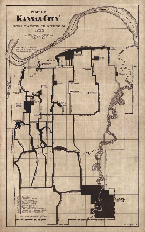
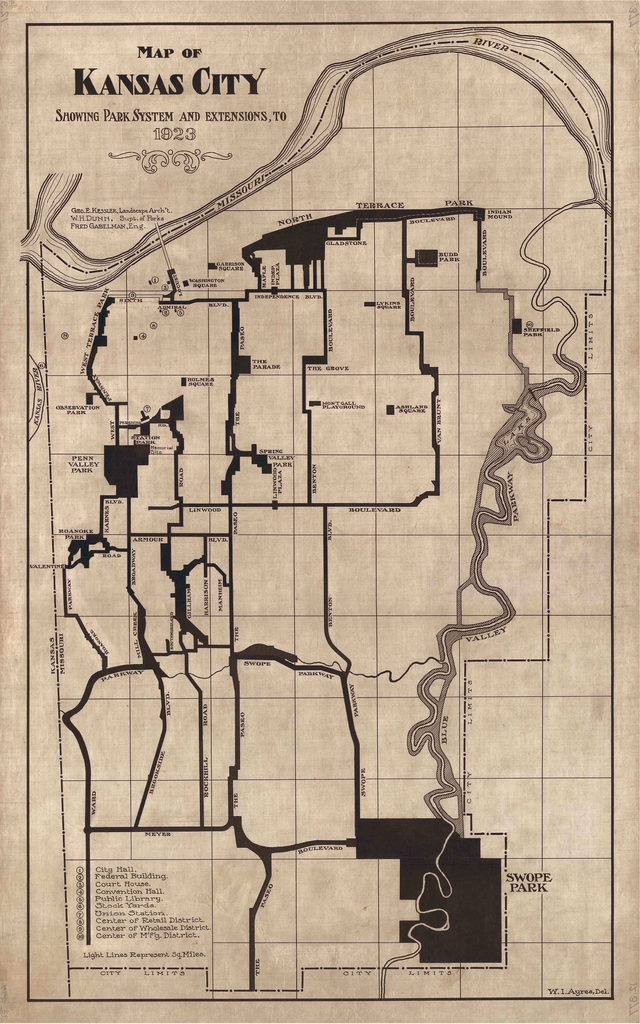
Deutsch: Plan des Kansas City Park- und Boulevard-System von 1923 |
| Date | |
| Source | Filled Multiple Property Documentation Form for The Kansas City System of Parks and Boulevards in the National Register of Historic Places |
| Author | George E. Kessler, W.H. Dunn, Fred Gabelman |
Licensing
[edit]
| This image or media file contains material based on a work of a National Park Service employee, created as part of that person's official duties. As a work of the U.S. federal government, such work is in the public domain in the United States. See the NPS website and NPS copyright policy for more information. |
File history
Click on a date/time to view the file as it appeared at that time.
| Date/Time | Thumbnail | Dimensions | User | Comment | |
|---|---|---|---|---|---|
| current | 16:05, 7 March 2021 | | 2,401 × 3,841 (13.59 MB) | Pechristener (talk | contribs) | Uploaded a work by George E. Kessler, W.H. Dunn, Fred Gabelman from Filled [https://www.nps.gov/nr/feature/places/pdfs/64501206.pdf Multiple Property Documentation Form] for ''The Kansas City System of Parks and Boulevards'' in the National Register of Historic Places with UploadWizard |
You cannot overwrite this file.
File usage on Commons
There are no pages that use this file.
File usage on other wikis
The following other wikis use this file:
- Usage on de.wikipedia.org