File:Map of Isle of Saint Louis, Senegal (1750).png
Jump to navigation
Jump to search
No higher resolution available.
Map_of_Isle_of_Saint_Louis,_Senegal_(1750).png (791 × 550 pixels, file size: 816 KB, MIME type: image/png)
Captions
Captions
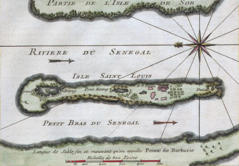
Map of Isle of Saint Louis, Senegal (1750)
Summary
[edit].png&action=edit§ion=1)
| Description |
English: Eighteenth century map of island at the mouth of the Senegal River |
| Date | |
| Source | https://www.geographicus.com/P/AntiqueMap/senegal-bellin-1750 |
| Author | Jacques-Nicolas Bellin |
Licensing
[edit].png&action=edit§ion=2)
|
This work is in the public domain in its country of origin and other countries and areas where the copyright term is the author's life plus 70 years or fewer. This work is in the public domain in the United States because it was published (or registered with the U.S. Copyright Office) before January 1, 1929. | |
| This file has been identified as being free of known restrictions under copyright law, including all related and neighboring rights. | |
File history
Click on a date/time to view the file as it appeared at that time.
| Date/Time | Thumbnail | Dimensions | User | Comment | |
|---|---|---|---|---|---|
| current | 21:56, 20 August 2021 | | 791 × 550 (816 KB) | Leutha (talk | contribs) | Uploaded a work by Jacques-Nicolas Bellin from https://www.geographicus.com/P/AntiqueMap/senegal-bellin-1750 with UploadWizard |
You cannot overwrite this file.
File usage on Commons
There are no pages that use this file.
.png&oldid=635284821)