File:Map of Isle de France (now Mauritius)-P6280065.JPG
Jump to navigation
Jump to search
Size of this preview: 462 × 599 pixels. Other resolutions: 185 × 240 pixels | 370 × 480 pixels | 592 × 768 pixels | 789 × 1,024 pixels | 1,579 × 2,048 pixels | 2,704 × 3,508 pixels.
Original file (2,704 × 3,508 pixels, file size: 1.61 MB, MIME type: image/jpeg)
Captions
Captions
Add a one-line explanation of what this file represents
Summary
[edit]-P6280065.JPG&action=edit§ion=1)
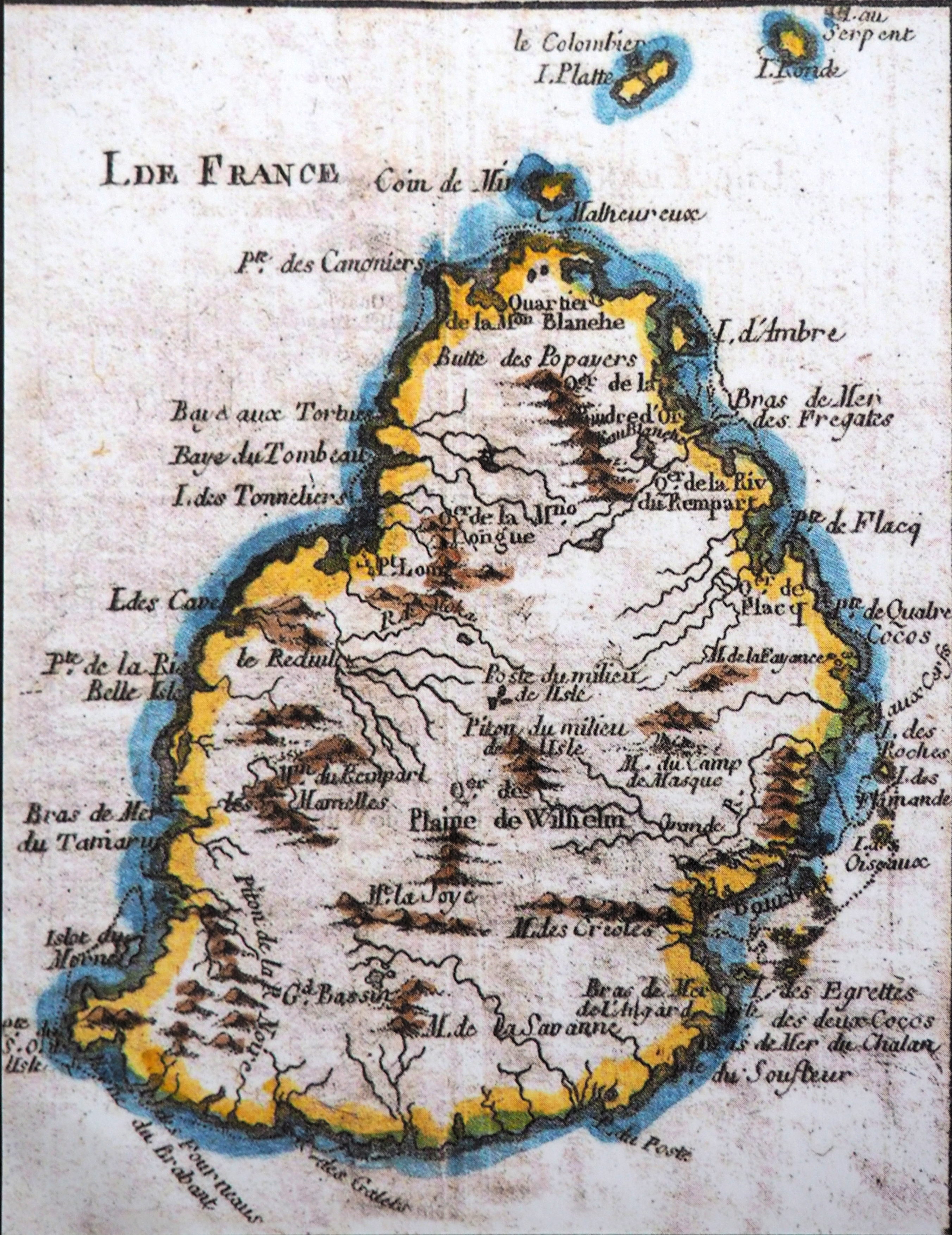
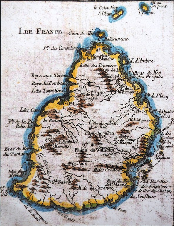
| Description | Map of Isle de France (now Mauritius) | ||||
| Date | 18th century | ||||
| Source | Roman, Alain (2018). Robert Surcouf, corsaire et armateur. Cristel éditions. ISBN 9782844211491. OCLC 1041768621. p. 36 | ||||
| Author | Unknown author | ||||
| Permission (Reusing this file) |
|
||||
File history
Click on a date/time to view the file as it appeared at that time.
| Date/Time | Thumbnail | Dimensions | User | Comment | |
|---|---|---|---|---|---|
| current | 12:13, 28 June 2020 | | 2,704 × 3,508 (1.61 MB) | Rama (talk | contribs) | {{Information |Description = Map of Isle de France (now Mauritius) |Source = Roman, Alain (2018). ''Robert Surcouf, corsaire et armateur''. Cristel éditions. ISBN 9782844211491. OCLC 1041768621. p. 36 |Date = 18th century |Author = unknown |Permission = {{Pd-old}} |other_versions = }} Category:Robert Surcouf, Corsaire et Armateur |
You cannot overwrite this file.
File usage on Commons
There are no pages that use this file.
File usage on other wikis
The following other wikis use this file:
- Usage on en.wikipedia.org
-P6280065.JPG&oldid=429724991)