File:Map of Indiana highlighting Posey County.svg
Jump to navigation
Jump to search

Size of this PNG preview of this SVG file: 391 × 599 pixels. Other resolutions: 156 × 240 pixels | 313 × 480 pixels | 501 × 768 pixels | 668 × 1,024 pixels | 1,337 × 2,048 pixels | 722 × 1,106 pixels.
Original file (SVG file, nominally 722 × 1,106 pixels, file size: 42 KB)
Captions
Captions
Add a one-line explanation of what this file represents
Summary
[edit]
| Description |
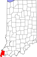
English: This is a locator map showing Posey County in Indiana. For more information, see Commons:United States county locator maps. |
| Date | |
| Source |
Own work: English: The maps use data from nationalatlas.gov, specifically countyp020.tar.gz on the Raw Data Download page. The maps also use state outline data from statesp020.tar.gz. The Florida maps use hydrogm020.tar.gz to display Lake Okeechobee. |
| Author | David Benbennick |
Licensing
[edit]
| I, the copyright holder of this work, release this work into the public domain. This applies worldwide. In some countries this may not be legally possible; if so: I grant anyone the right to use this work for any purpose, without any conditions, unless such conditions are required by law. |
File history
Click on a date/time to view the file as it appeared at that time.
| Date/Time | Thumbnail | Dimensions | User | Comment | |
|---|---|---|---|---|---|
| current | 20:41, 19 June 2024 | | 722 × 1,106 (42 KB) | Nux (talk | contribs) | fix rendering (remove clipping) |
| 12:11, 12 February 2006 |  | 2,887 × 4,423 (56 KB) | David Benbennick (talk | contribs) | {{subst:User:Dbenbenn/clm|county=Posey County|state=Indiana}} |
You cannot overwrite this file.
File usage on Commons
The following 8 pages use this file:
- Category:Births in Posey County, Indiana
- Category:Deaths in Posey County, Indiana
- Category:Historic districts in Posey County, Indiana
- Category:Maps of Posey County, Indiana
- Category:National Register of Historic Places in Posey County, Indiana
- Category:People of Posey County, Indiana
- Category:Posey County, Indiana
- Category:Posey County, Indiana Image by Chris Light
File usage on other wikis
The following other wikis use this file:
- Usage on ar.wikipedia.org
- Usage on azb.wikipedia.org
- Usage on bg.wikipedia.org
- Usage on bpy.wikipedia.org
- Usage on cdo.wikipedia.org
- Usage on ceb.wikipedia.org
- Usage on ce.wikipedia.org
- Usage on cy.wikipedia.org
- Usage on de.wikipedia.org
- Usage on en.wikipedia.org
- List of counties in Indiana
- Posey County, Indiana
- Cynthiana, Indiana
- Griffin, Indiana
- Mount Vernon, Indiana
- New Harmony, Indiana
- Poseyville, Indiana
- Harmonie State Park
- Template:Posey County, Indiana
- Bethel Township, Posey County, Indiana
- Black Township, Posey County, Indiana
- Center Township, Posey County, Indiana
- Harmony Township, Posey County, Indiana
- Lynn Township, Posey County, Indiana
- Marrs Township, Posey County, Indiana
- Point Township, Posey County, Indiana
- Robb Township, Posey County, Indiana
- Robinson Township, Posey County, Indiana
- Smith Township, Posey County, Indiana
- Template:PoseyCountyIN-geo-stub
- Wadesville, Indiana
- User:Nyttend/County templates/IN/2
- Hovey Lake Fish and Wildlife Area
- National Register of Historic Places listings in Posey County, Indiana
- Solitude, Indiana
- Black River (Indiana)
- Hovey Lake-Klein Archeological Site
- Welborn Village Archeological Site
- Wikipedia:Graphics Lab/Map workshop/Archive/Jan 2011
- Category:Populated places in Posey County, Indiana
- List of Indiana state historical markers in Posey County
- Blairsville, Indiana
- Parkers Settlement, Indiana
- Rapture, Indiana
View more global usage of this file.