File:Map of Indiana State Road 445.svg
Jump to navigation
Jump to search

Size of this PNG preview of this SVG file: 800 × 471 pixels. Other resolutions: 320 × 188 pixels | 640 × 377 pixels | 1,024 × 603 pixels | 1,280 × 753 pixels | 2,560 × 1,506 pixels | 1,006 × 592 pixels.
Original file (SVG file, nominally 1,006 × 592 pixels, file size: 222 KB)
Captions
Captions
Add a one-line explanation of what this file represents
Summary
[edit]
| Description |
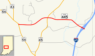
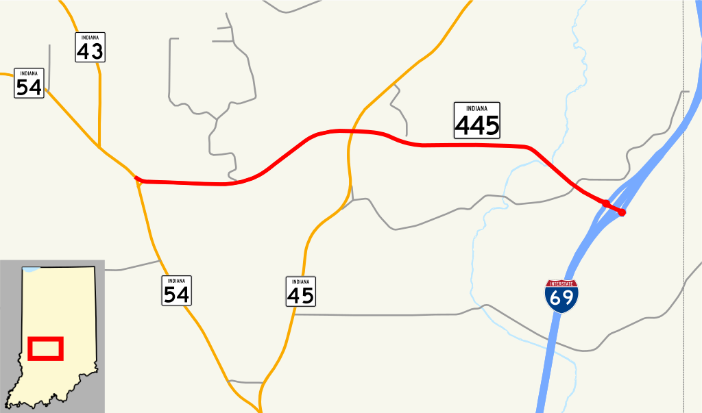
English: This is a map which shows the route of Indiana State Road 445 in the United States. |
| Date | |
| Source | My own work, using freely-available shape data and custom-written MapScript applications |
| Author | Travisarch, originally by Omnedon |
Licensing
[edit]
| I, the copyright holder of this work, release this work into the public domain. This applies worldwide. In some countries this may not be legally possible; if so: I grant anyone the right to use this work for any purpose, without any conditions, unless such conditions are required by law. |
File history
Click on a date/time to view the file as it appeared at that time.
| Date/Time | Thumbnail | Dimensions | User | Comment | |
|---|---|---|---|---|---|
| current | 00:19, 30 January 2017 | | 1,006 × 592 (222 KB) | Travisarch (talk | contribs) | added I-69 |
| 03:15, 5 March 2008 |  | 870 × 516 (7 KB) | Omnedon (talk | contribs) | {{Information |Description={{en|This is a map which shows the route of Indiana State Road 445 in the United States.}} |Source=My own work, using freely-available shape data and custom-written MapScript applications |Date=2008 | |
| 02:35, 5 March 2008 |  | 870 × 516 (6 KB) | Omnedon (talk | contribs) | {{Information |Description={{en|This is a map which shows the route of Indiana State Road 445 in the United States.}} |Source=My own work, using freely-available shape data and custom-written MapScript applications |Date=2008 |
You cannot overwrite this file.
File usage on Commons
The following 3 pages use this file:
File usage on other wikis
The following other wikis use this file:
- Usage on www.wikidata.org
- Usage on zh-min-nan.wikipedia.org