File:Map of Idaho highlighting Ada County.svg
Jump to navigation
Jump to search

Size of this PNG preview of this SVG file: 389 × 600 pixels. Other resolutions: 155 × 240 pixels | 311 × 480 pixels | 498 × 768 pixels | 664 × 1,024 pixels | 1,328 × 2,048 pixels | 633 × 976 pixels.
Original file (SVG file, nominally 633 × 976 pixels, file size: 82 KB)
Captions
Captions
Add a one-line explanation of what this file represents
Summary
[edit]
| Description |
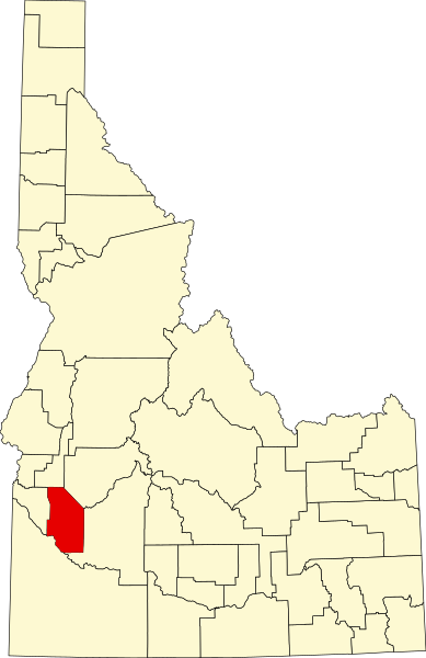
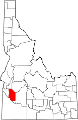
English: This is a locator map showing Ada County in Idaho. For more information, see Commons:United States county locator maps. |
| Date | |
| Source |
Own work: English: The maps use data from nationalatlas.gov, specifically countyp020.tar.gz on the Raw Data Download page. The maps also use state outline data from statesp020.tar.gz. The Florida maps use hydrogm020.tar.gz to display Lake Okeechobee. |
| Author | David Benbennick |
Licensing
[edit]
| I, the copyright holder of this work, release this work into the public domain. This applies worldwide. In some countries this may not be legally possible; if so: I grant anyone the right to use this work for any purpose, without any conditions, unless such conditions are required by law. |
derivative works
[edit]
Derivative works of this file: Idaho Transportation Department districts.png
File history
Click on a date/time to view the file as it appeared at that time.
| Date/Time | Thumbnail | Dimensions | User | Comment | |
|---|---|---|---|---|---|
| current | 14:00, 25 June 2024 | | 633 × 976 (82 KB) | Nux (talk | contribs) | uniform colors with good contrast |
| 20:10, 19 June 2024 |  | 1,265 × 1,951 (82 KB) | Nux (talk | contribs) | fix rendering (remove clipping) | |
| 11:06, 12 February 2006 |  | 5,061 × 7,805 (109 KB) | David Benbennick (talk | contribs) | {{subst:User:Dbenbenn/clm|county=Ada County|state=Idaho}} |
You cannot overwrite this file.
File usage on Commons
The following 9 pages use this file:
- File:Idaho Transportation Department districts.png
- Category:Ada County, Idaho
- Category:Ada County, Idaho Image by Chris Light
- Category:Births in Ada County, Idaho
- Category:Deaths in Ada County, Idaho
- Category:Geography of Ada County, Idaho
- Category:Maps of Ada County, Idaho
- Category:People of Ada County, Idaho
- Category:Populated places in Ada County, Idaho
File usage on other wikis
The following other wikis use this file:
- Usage on ar.wikipedia.org
- Usage on azb.wikipedia.org
- Usage on bg.wikipedia.org
- Usage on bpy.wikipedia.org
- Usage on cdo.wikipedia.org
- Usage on ceb.wikipedia.org
- Usage on ce.wikipedia.org
- Usage on cs.wikipedia.org
- Usage on cy.wikipedia.org
- Usage on de.wikipedia.org
- Usage on en.wikipedia.org
- Boise, Idaho
- List of counties in Idaho
- Ada County, Idaho
- Eagle, Idaho
- Garden City, Idaho
- Kuna, Idaho
- Meridian, Idaho
- Star, Idaho
- Arboretum Park
- Template:Ada County, Idaho
- User:Nyttend/County templates/ID
- Lucky Peak Lake
- National Register of Historic Places listings in Ada County, Idaho
- Template:US county navigation box/testcases
- Hidden Springs, Idaho
- Category:Populated places in Ada County, Idaho
- Timeline of Boise, Idaho
- Boise Fire Department
- Ann Morrison Park
- Kristin Armstrong Municipal Park
- List of parks in Boise
- South Eighth Street Historic District
- Avimor, Idaho
- Owyhee, Idaho
View more global usage of this file.