File:Map of Greater Italia (coloured).svg
Jump to navigation
Jump to search

Size of this PNG preview of this SVG file: 655 × 599 pixels. Other resolutions: 262 × 240 pixels | 525 × 480 pixels | 839 × 768 pixels | 1,119 × 1,024 pixels | 2,239 × 2,048 pixels | 940 × 860 pixels.
Original file (SVG file, nominally 940 × 860 pixels, file size: 907 KB)
Captions
Captions
Add a one-line explanation of what this file represents
Summary
[edit].svg&action=edit§ion=1)
| Description |
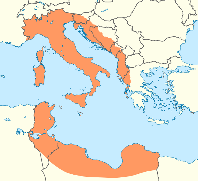
Deutsch: Positionskarte des Mittelmeers Quadratische Plattkarte, N-S-Streckung 128 %. Geographische Begrenzung der Karte: * N: 48.0° N * S: 29.0° N * W: 7.0° W * O: 42.5° O English: Location map of the Mediterranean Sea Equirectangular projection, N/S stretching 128 %. Geographic limits of the map: * N: 48.0° N * S: 29.0° N * W: 7.0° W * E: 42.5° E |
| Date | (UTC) |
| Source |
This file was derived from: Mediterranean Sea location map.svg: |
| Author |
|
Licensing
[edit].svg&action=edit§ion=2)
I, the copyright holder of this work, hereby publish it under the following license:
This file is licensed under the Creative Commons Attribution-Share Alike 3.0 Unported license.
- You are free:
- to share – to copy, distribute and transmit the work
- to remix – to adapt the work
- Under the following conditions:
- attribution – You must give appropriate credit, provide a link to the license, and indicate if changes were made. You may do so in any reasonable manner, but not in any way that suggests the licensor endorses you or your use.
- share alike – If you remix, transform, or build upon the material, you must distribute your contributions under the same or compatible license as the original.
Original upload log
[edit].svg&action=edit§ion=3)
This image is a derivative work of the following images:
- File:Mediterranean_Sea_location_map.svg licensed with Cc-by-sa-3.0
- 2010-09-08T08:58:38Z NordNordWest 1754x862 (1246819 Bytes) =={{int:filedesc}}== {{Information |Description= {{de|Positionskarte des [[:de:Mittelmeer|Mittelmeers]]}} Quadratische Plattkarte, N-S-Streckung 128 %. Geographische Begrenzung der Karte: * N: 48.0° N * S: 29.0° N * W: 7.0�
Uploaded with derivativeFX
File history
Click on a date/time to view the file as it appeared at that time.
| Date/Time | Thumbnail | Dimensions | User | Comment | |
|---|---|---|---|---|---|
| current | 21:23, 12 January 2012 | | 940 × 860 (907 KB) | NikNaks (talk | contribs) | == {{int:filedesc}} == {{Information |Description={{de|Positionskarte des Mittelmeers}} Quadratische Plattkarte, N-S-Streckung 128 %. Geographische Begrenzung der Karte: * N: 48.0° N * S: 29.0° N * W: 7.0° W * O: 42.5° O {{en|Locati |
You cannot overwrite this file.
File usage on Commons
The following page uses this file:
.svg&oldid=490787681)