File:Map of Glencairn's Rising.svg
Jump to navigation
Jump to search

Size of this PNG preview of this SVG file: 570 × 600 pixels. Other resolutions: 228 × 240 pixels | 456 × 480 pixels | 730 × 768 pixels | 973 × 1,024 pixels | 1,946 × 2,048 pixels | 2,088 × 2,197 pixels.
Original file (SVG file, nominally 2,088 × 2,197 pixels, file size: 2.73 MB)
Captions
Captions
Add a one-line explanation of what this file represents
Summary
[edit]
| Description |
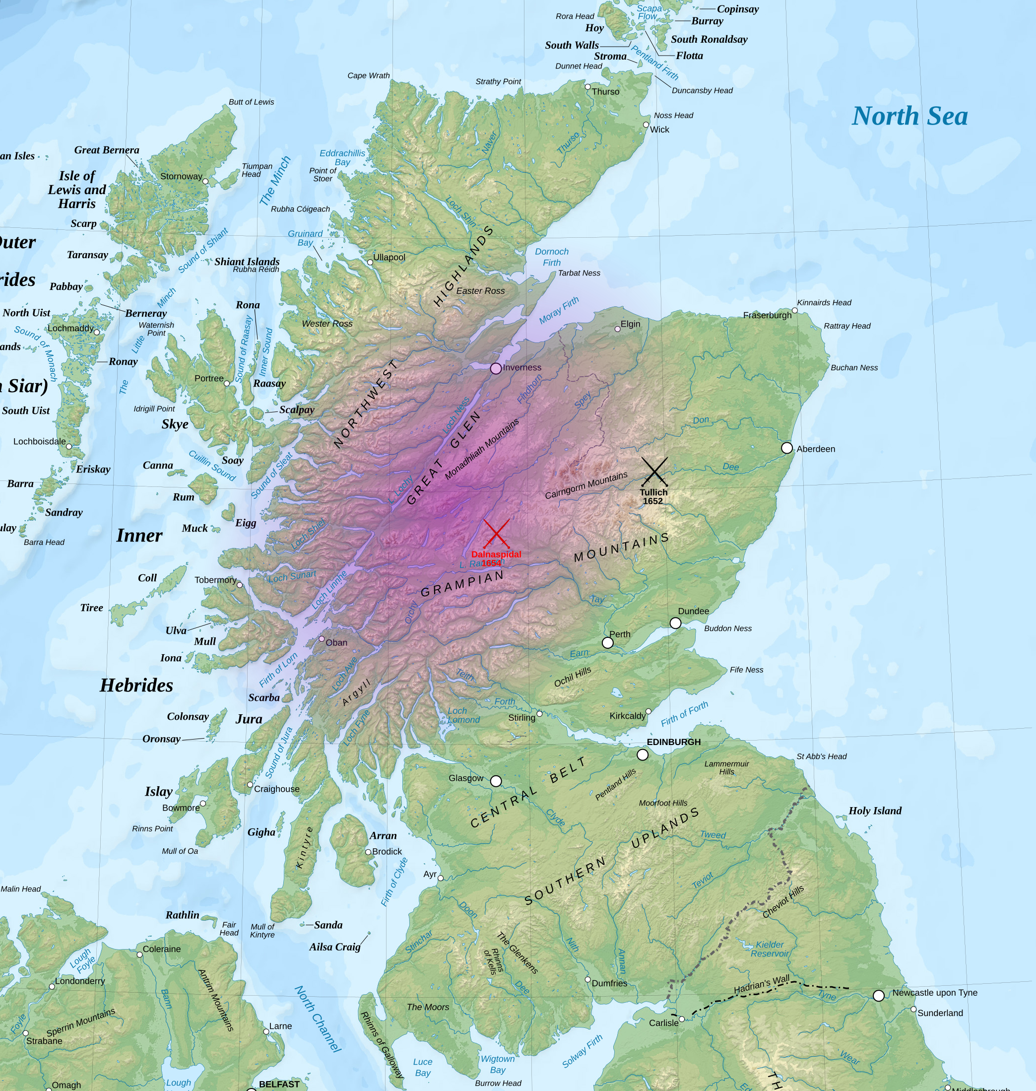
English: Map of Glencairn's Rising during the War of the Three Kingdoms.
The purple shaded area is the area where support for Glencairn's royalist rising was strongest. Also marked are the two battles connected with the rising. The Battle of Dalnaspidal is shaded red to show it as a Protectorate victory, whilst Tullich is black to represent it as having an unclear result. |
| Date | |
| Source | Own work |
| Author | MrPenguin20 |
| Permission (Reusing this file) |
This vector image includes elements that have been taken or adapted from this file: |
Licensing
[edit]
I, the copyright holder of this work, hereby publish it under the following license:
This file is licensed under the Creative Commons Attribution-Share Alike 4.0 International license.
- You are free:
- to share – to copy, distribute and transmit the work
- to remix – to adapt the work
- Under the following conditions:
- attribution – You must give appropriate credit, provide a link to the license, and indicate if changes were made. You may do so in any reasonable manner, but not in any way that suggests the licensor endorses you or your use.
- share alike – If you remix, transform, or build upon the material, you must distribute your contributions under the same or compatible license as the original.
File history
Click on a date/time to view the file as it appeared at that time.
| Date/Time | Thumbnail | Dimensions | User | Comment | |
|---|---|---|---|---|---|
| current | 02:57, 17 November 2014 | | 2,088 × 2,197 (2.73 MB) | MrPenguin20 (talk | contribs) | User created page with UploadWizard |
You cannot overwrite this file.
File usage on Commons
There are no pages that use this file.