File:Map of Domet Survey District (unknown date).jpg
Jump to navigation
Jump to search

Size of this preview: 453 × 599 pixels. Other resolutions: 181 × 240 pixels | 363 × 480 pixels | 580 × 768 pixels | 774 × 1,024 pixels | 1,548 × 2,048 pixels | 6,027 × 7,973 pixels.
Original file (6,027 × 7,973 pixels, file size: 2.51 MB, MIME type: image/jpeg)
Captions
Captions
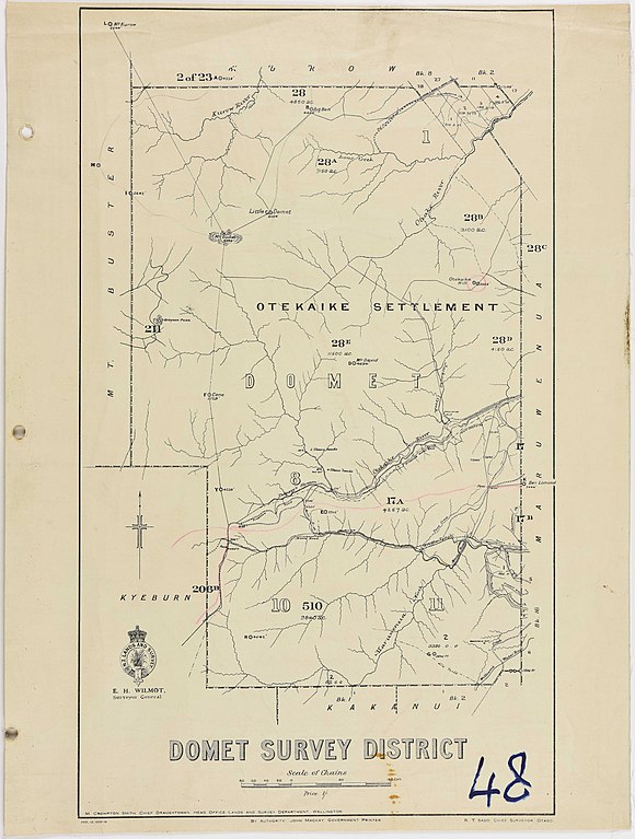
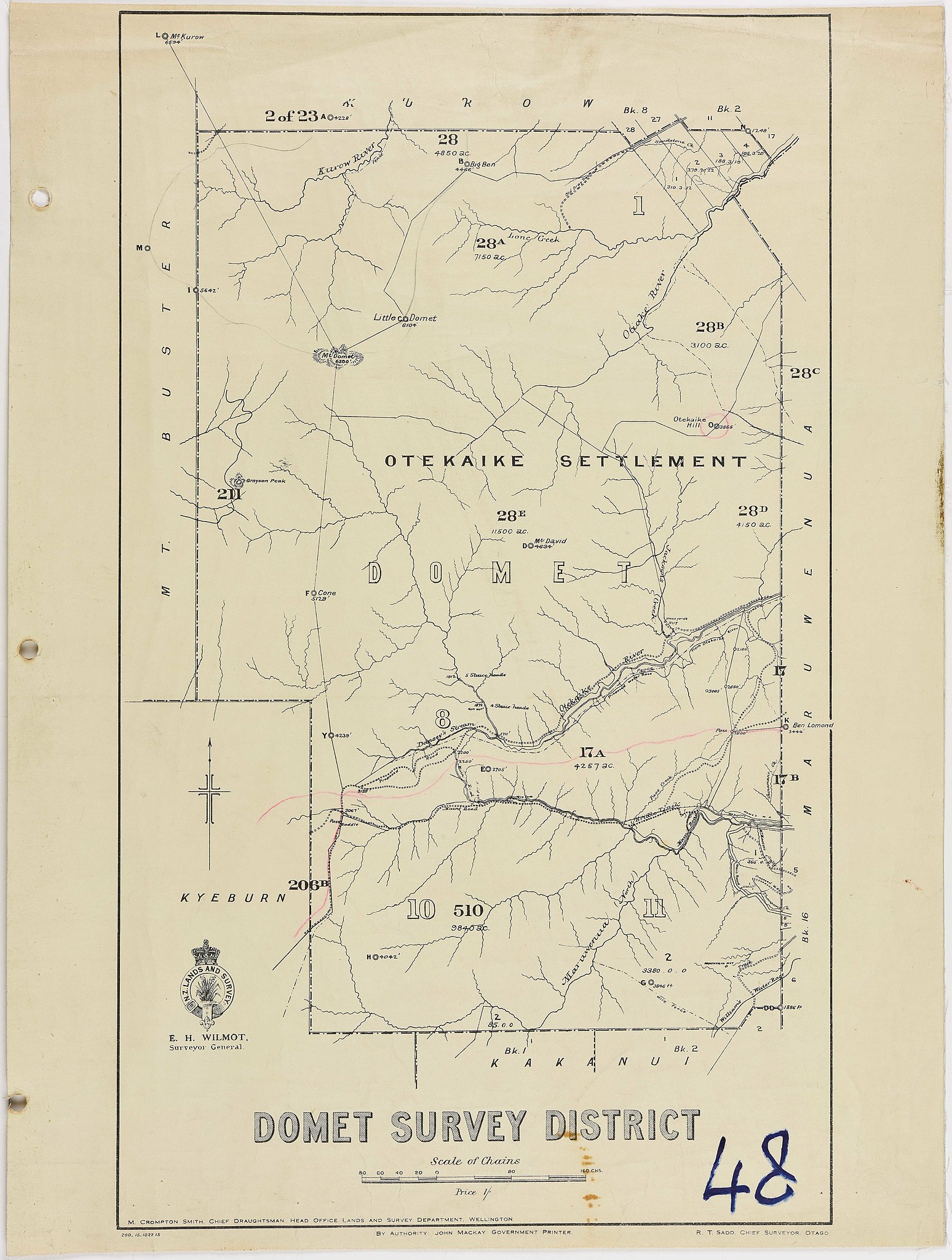
Map of Domet Survey District (unknown date)
Summary
[edit].jpg&action=edit§ion=1)
| Description |
English: Domet Survey District - [bound in folder of 50 Cadastral Maps published by Lands and Survey Department] (unknown date) - New Zealand Archives Reference: DABB D101 409/48 - R6619079 |
| Date | Unknown date |
| Source | https://ndhadeliver.natlib.govt.nz/delivery/DeliveryManagerServlet?dps_pid=IE39572570 |
| Author | New Zealand Railways Corporation, District Engineer's Office, Dunedin |
Licensing
[edit].jpg&action=edit§ion=2)
This file is licensed under the Creative Commons Attribution 2.0 Generic license.
- You are free:
- to share – to copy, distribute and transmit the work
- to remix – to adapt the work
- Under the following conditions:
- attribution – You must give appropriate credit, provide a link to the license, and indicate if changes were made. You may do so in any reasonable manner, but not in any way that suggests the licensor endorses you or your use.
https://archives.govt.nz/copyright
Material that Archives New Zealand has published on Archway, Flickr and our website is under Creative Commons 2.0 where reuse is allowed if the material is attributed to Archives New Zealand.
File history
Click on a date/time to view the file as it appeared at that time.
| Date/Time | Thumbnail | Dimensions | User | Comment | |
|---|---|---|---|---|---|
| current | 23:16, 29 March 2020 | | 6,027 × 7,973 (2.51 MB) | F.newnham (talk | contribs) | Uploaded a work by New Zealand Railways Corporation, District Engineer's Office, Dunedin from https://ndhadeliver.natlib.govt.nz/delivery/DeliveryManagerServlet?dps_pid=IE39572570 with UploadWizard |
You cannot overwrite this file.
File usage on Commons
There are no pages that use this file.
.jpg&oldid=793855558)