File:Map of Chungcheongnam-do.png
Jump to navigation
Jump to search
No higher resolution available.
Map_of_Chungcheongnam-do.png (320 × 254 pixels, file size: 31 KB, MIME type: image/png)
Captions
Captions
Add a one-line explanation of what this file represents
Summary
[edit]
| Description |
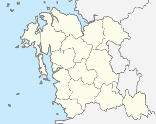
English: Map of Chungcheongnam-do
한국어: 충청남도의 행정 구역 |
| Date | |
| Source | Own work |
| Author | Geoarchive |

|
File:Map Chungcheongnam-do.svg is a vector version of this file. It should be used in place of this PNG file when not inferior.
File:Map of Chungcheongnam-do.png → File:Map Chungcheongnam-do.svg
For more information, see Help:SVG. |
 |
Licensing
[edit]
| I, the copyright holder of this work, release this work into the public domain. This applies worldwide. In some countries this may not be legally possible; if so: I grant anyone the right to use this work for any purpose, without any conditions, unless such conditions are required by law. |
File history
Click on a date/time to view the file as it appeared at that time.
| Date/Time | Thumbnail | Dimensions | User | Comment | |
|---|---|---|---|---|---|
| current | 10:34, 2 June 2012 | | 320 × 254 (31 KB) | Geoarchive (talk | contribs) |
You cannot overwrite this file.
File usage on Commons
There are no pages that use this file.
File usage on other wikis
The following other wikis use this file:
- Usage on fr.wikipedia.org
- Usage on ko.wikipedia.org
- Usage on vi.wikipedia.org