File:Map of Caucasus Krai 1903.jpg

Original file (10,000 × 9,334 pixels, file size: 41.85 MB, MIME type: image/jpeg)
Captions
Captions
| Warning | The original file is very high-resolution. It might not load properly or could cause your browser to freeze when opened at full size. |
|---|
| Description |
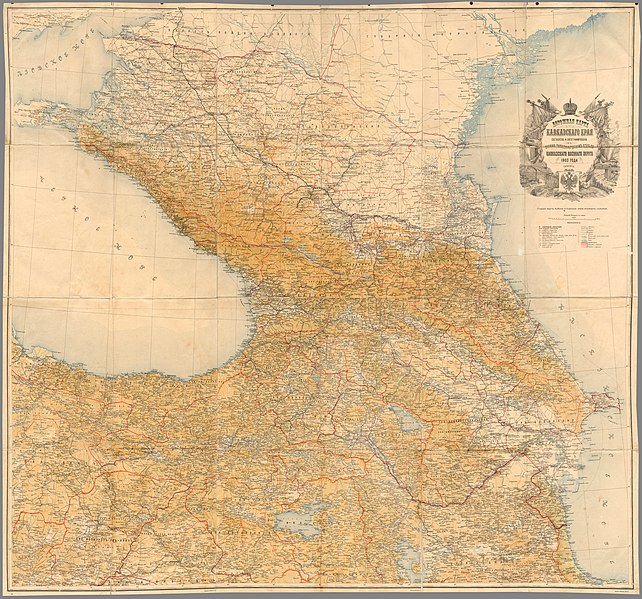
Русский: Дорожная карта Кавказского края 1903 года. Составлена и литографирована в военно-топографическом отделе Кавказского военного округа. г. Тифлис. Масштаб 20 вёрст в английском дюйме 1:840000 |
|||
| Date | ||||
| Source | ЭтоМесто.Ру | |||
| Author |
Русский: Карту гравировал И. Михайлов |
|||
| Permission (Reusing this file) |
|
|||
| Other versions |
|

.png)
File history
Click on a date/time to view the file as it appeared at that time.
| Date/Time | Thumbnail | Dimensions | User | Comment | |
|---|---|---|---|---|---|
| current | 21:51, 9 November 2018 | | 10,000 × 9,334 (41.85 MB) | Karaagash (talk | contribs) | User created page with UploadWizard |
You cannot overwrite this file.
File usage on Commons
The following page uses this file:
File usage on other wikis
The following other wikis use this file:
- Usage on lv.wikipedia.org
- Usage on ru.wikipedia.org