File:Map of Britannia Village, original, purchased NAPL, clipped, 1968, spots removed, labelled, aspect ratio, final.jpg
Jump to navigation
Jump to search

Size of this preview: 800 × 594 pixels. Other resolutions: 320 × 238 pixels | 640 × 475 pixels | 1,024 × 760 pixels | 1,280 × 950 pixels | 2,560 × 1,901 pixels | 2,904 × 2,156 pixels.
Original file (2,904 × 2,156 pixels, file size: 3.58 MB, MIME type: image/jpeg)
Captions
Captions
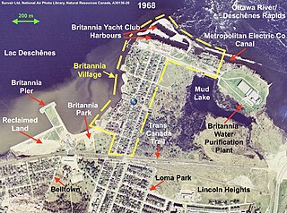
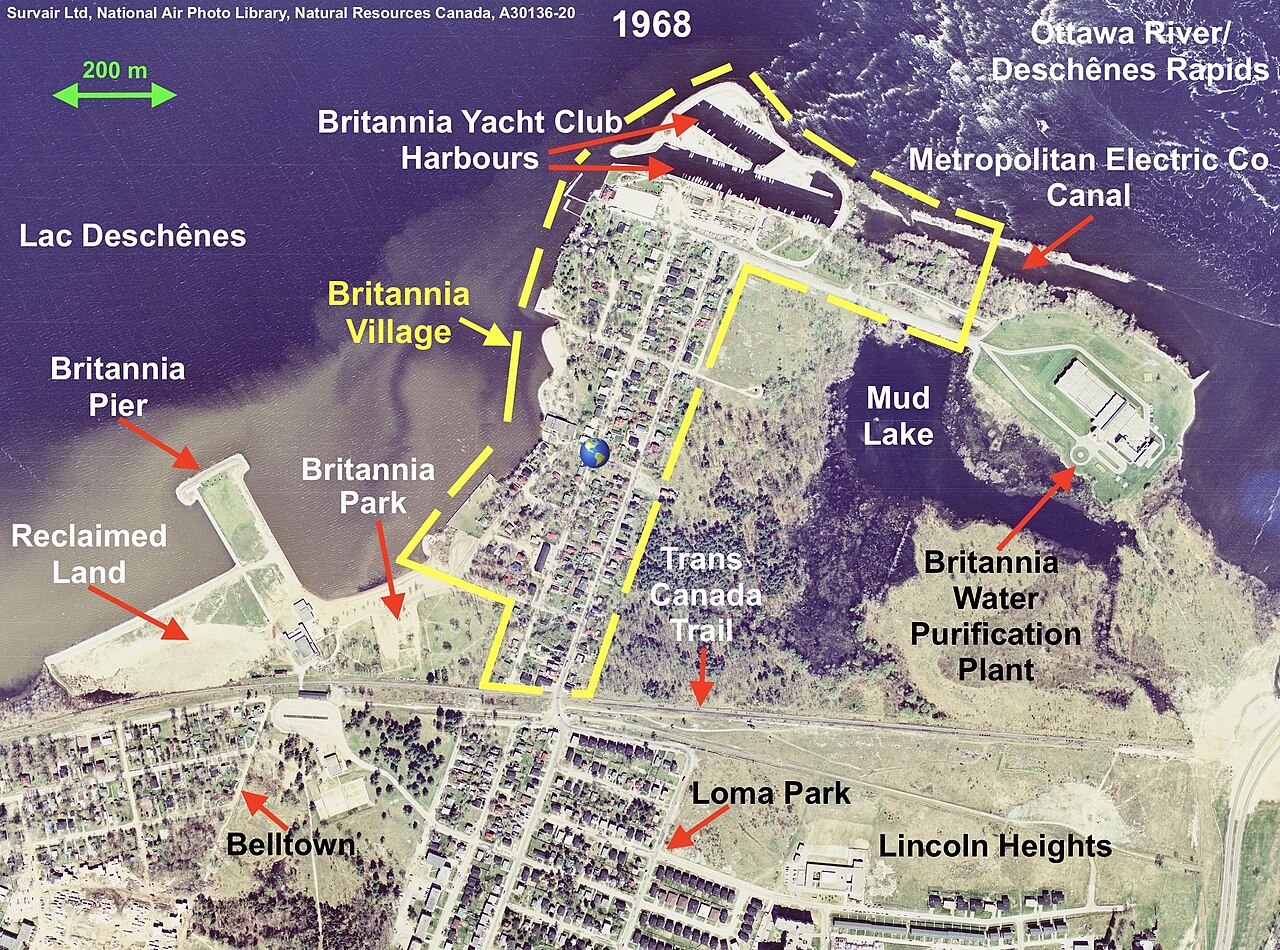
Map of Britannia Village
Summary
[edit]
| Description |
English: Survair Limited, Ottawa took this photo as part of a federal government initiative to photograph all regions of Canada. |
| Date | |
| Source | The photo (A30136-20) was purchased from the National Air Photo Library, Natural Resources Canada, Ottawa. |
| Author | Survair Limited, Ottawa |
| Permission (Reusing this file) |
Licensing
[edit]
This file is licensed under the Creative Commons Attribution-Share Alike 4.0 International license.
- You are free:
- to share – to copy, distribute and transmit the work
- to remix – to adapt the work
- Under the following conditions:
- attribution – You must give appropriate credit, provide a link to the license, and indicate if changes were made. You may do so in any reasonable manner, but not in any way that suggests the licensor endorses you or your use.
- share alike – If you remix, transform, or build upon the material, you must distribute your contributions under the same or compatible license as the original.
File history
Click on a date/time to view the file as it appeared at that time.
| Date/Time | Thumbnail | Dimensions | User | Comment | |
|---|---|---|---|---|---|
| current | 14:30, 12 December 2023 | | 2,904 × 2,156 (3.58 MB) | Robert Neustadter (talk | contribs) | Reverted to version as of 13:40, 4 November 2023 (UTC) |
| 14:29, 12 December 2023 |  | 2,904 × 2,156 (3.61 MB) | Robert Neustadter (talk | contribs) | Yesterday, unfortunately, I erred in uploading a partially-labeled version of this photo rather than a completely unlabelled version which I have now done. | |
| 02:41, 12 December 2023 |  | 2,904 × 2,156 (3.58 MB) | Robert Neustadter (talk | contribs) | Reverted to version as of 13:40, 4 November 2023 (UTC) | |
| 02:40, 12 December 2023 |  | 2,904 × 2,156 (3.56 MB) | Robert Neustadter (talk | contribs) | This is the unlabelled version of the photo. | |
| 13:40, 4 November 2023 |  | 2,904 × 2,156 (3.58 MB) | Robert Neustadter (talk | contribs) | re-labelled Britannia Village (now in yellow) and Park (added Britannia) | |
| 18:01, 28 September 2023 |  | 2,904 × 2,156 (3.58 MB) | Robert Neustadter (talk | contribs) | Uploaded a work by Survair Limited, Ottawa from The photo (A30136-20) was purchased from the National Air Photo Library, Natural Resources Canada, Ottawa. with UploadWizard |
You cannot overwrite this file.
File usage on Commons
The following 2 pages use this file:
File usage on other wikis
The following other wikis use this file:
- Usage on en.wikipedia.org