File:Map of Biloxi and Mississippi coast.png
Jump to navigation
Jump to search
No higher resolution available.
Map_of_Biloxi_and_Mississippi_coast.png (514 × 482 pixels, file size: 13 KB, MIME type: image/png)
Captions
Captions
Add a one-line explanation of what this file represents
| Description |
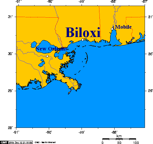
English: Ports of New Orleans - Biloxi - Mobile This map was created using this online map creation tool. |
| Date | 12 December 2004 (original upload date) |
| Source |
Transferred from en.wikipedia to Commons. |
| Author | The original uploader was Geo Swan at English Wikipedia. |
| Permission (Reusing this file) |
CC-BY-SA-3.0-MIGRATED; GFDL-WITH-DISCLAIMERS; Released under the GNU Free Documentation License. |
Transferred from en.wikipedia to Commons by Maksim.

|
Permission is granted to copy, distribute and/or modify this document under the terms of the GNU Free Documentation License, Version 1.2 or any later version published by the Free Software Foundation; with no Invariant Sections, no Front-Cover Texts, and no Back-Cover Texts. A copy of the license is included in the section entitled GNU Free Documentation License. |
| This file is licensed under the Creative Commons Attribution-Share Alike 3.0 Unported license. | ||
| ||
| This licensing tag was added to this file as part of the GFDL licensing update. |
| I, the copyright holder of this work, release this work into the public domain. This applies worldwide. In some countries this may not be legally possible; if so: I grant anyone the right to use this work for any purpose, without any conditions, unless such conditions are required by law. |
This map was created using this online map creation tool archive copy at the Wayback Machine.
| date/time | username | edit summary |
|---|---|---|
| 20:20, 12 December 2004 | en:User:Geo Swan | (Biloxi and the Mississippi coast) |
| 20:16, 12 December 2004 | en:User:Geo Swan | (Biloxi and the Mississippi coast) |
Original upload log
[edit]
Legend: (cur) = this is the current file, (del) = delete this old version, (rev) = revert to this old version.
Click on date to download the file or see the image uploaded on that date.
- (del) (cur) 20:16, 12 December 2004 . . en:User:Geo_Swan Geo Swan ( en:User_talk:Geo_Swan Talk) . . 514x482 (13435 bytes) (Biloxi and the Mississippi coast)
File history
Click on a date/time to view the file as it appeared at that time.
| Date/Time | Thumbnail | Dimensions | User | Comment | |
|---|---|---|---|---|---|
| current | 08:25, 26 March 2006 | | 514 × 482 (13 KB) | Maksim (talk | contribs) | La bildo estas kopiita de wikipedia:en. La originala priskribo estas: Biloxi and the Mississippi coast {{GFDL}} This map was created using this [http://www.aquarius.geomar.de/omc/ online map creation tool]. {| border="1" ! date/time || username || edi |
You cannot overwrite this file.
File usage on Commons
There are no pages that use this file.
File usage on other wikis
The following other wikis use this file:
- Usage on en.wikipedia.org
- Usage on eo.wikipedia.org
- Usage on fa.wikipedia.org
- Usage on hu.wikipedia.org