File:Map of Belleville, 1860 (31627486855).jpg

Original file (5,376 × 5,972 pixels, file size: 3.56 MB, MIME type: image/jpeg)
Captions
Captions
Summary
[edit].jpg&action=edit§ion=1)
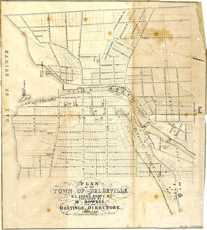
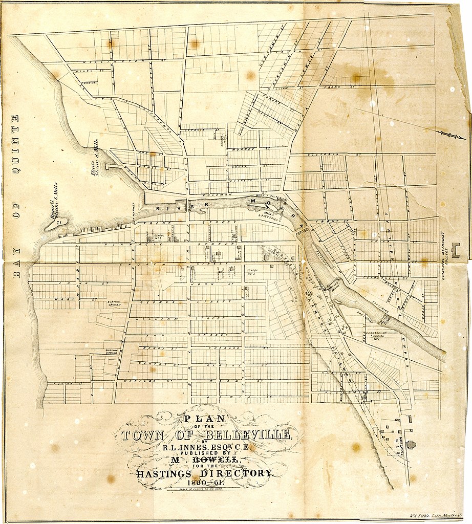
| Description | Map of Belleville, Ontario, from the 1860-1861 Hastings County Directory. |
| Date | |
| Source | Map of Belleville, 1860 |
| Author | Community Archives |
| Camera location | | View this and other nearby images on: OpenStreetMap |
|---|
.jpg¶ms=044.166121_N_-077.386858_E_globe:Earth_type:camera_source:Flickr_&language=en)
Licensing
[edit].jpg&action=edit§ion=2)
This Canadian work is in the public domain in Canada because its copyright has expired due to one of the following:
it was not subject to Crown copyright, and
|
 |
| This image, originally posted to Flickr, was reviewed on 20 November 2019 by the administrator or reviewer Alex Cohn, who confirmed that it was available on Flickr under the stated license on that date. |
File history
Click on a date/time to view the file as it appeared at that time.
| Date/Time | Thumbnail | Dimensions | User | Comment | |
|---|---|---|---|---|---|
| current | 00:02, 27 April 2018 | | 5,376 × 5,972 (3.56 MB) | SteinsplitterBot (talk | contribs) | Bot: Image rotated by 90° |
| 22:41, 26 April 2018 |  | 5,972 × 5,381 (3.23 MB) | Mindmatrix (talk | contribs) | Transferred from Flickr via #flickr2commons |
You cannot overwrite this file.
File usage on Commons
There are no pages that use this file.
.jpg&oldid=905135840)