File:Map of Attica.jpg
Jump to navigation
Jump to search

Size of this preview: 635 × 600 pixels. Other resolutions: 254 × 240 pixels | 508 × 480 pixels | 813 × 768 pixels | 1,084 × 1,024 pixels | 1,300 × 1,228 pixels.
Original file (1,300 × 1,228 pixels, file size: 727 KB, MIME type: image/jpeg)
Captions
Captions
Add a one-line explanation of what this file represents
| Description |
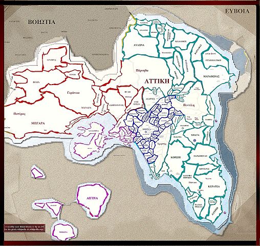
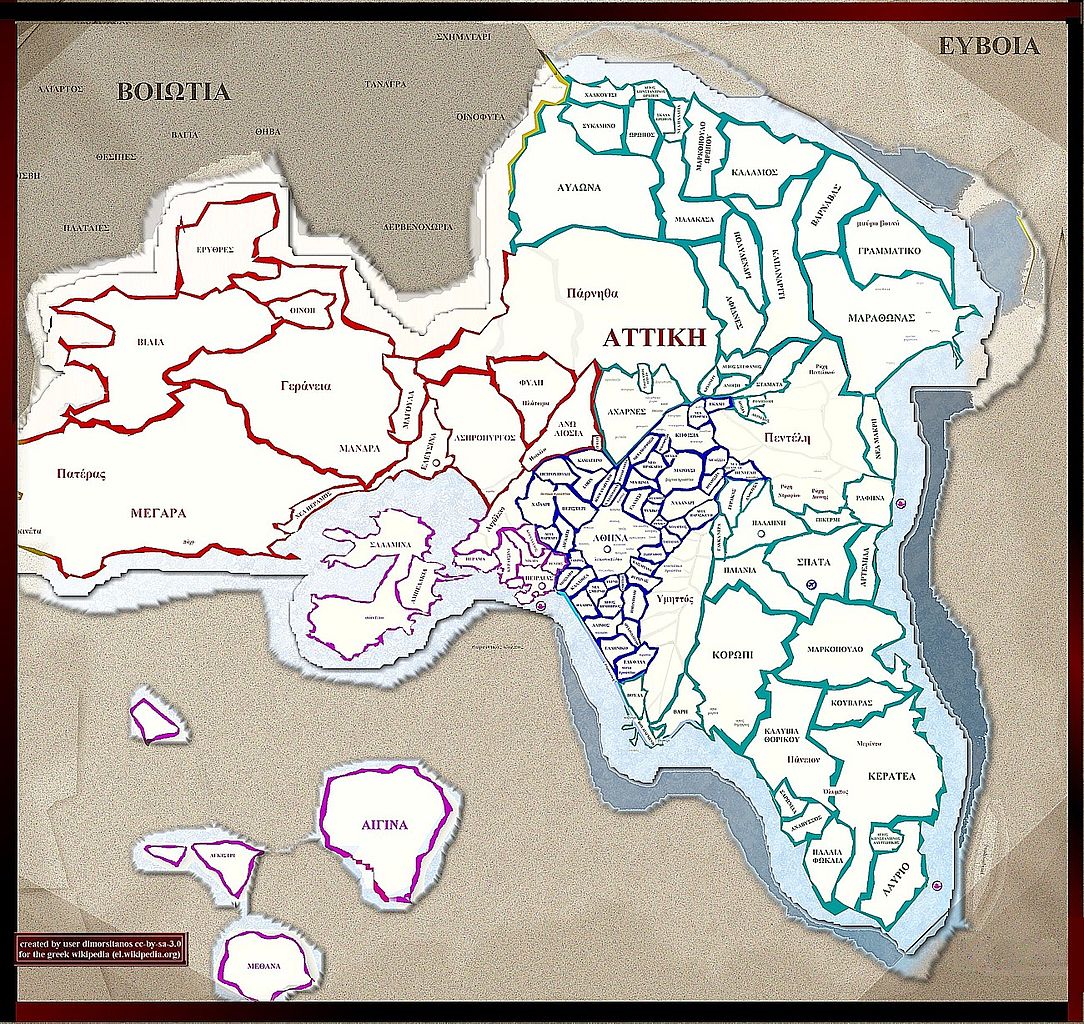
English: Map of Attica, Greece Ελληνικά: Χάρτης της Αττικής |
| Date | |
| Source | Own work; transferred from el.wikipedia; transferred to Commons by User:MARKELLOS using CommonsHelper |
| Author | Dimorsitanos |
| Permission (Reusing this file) |
CC-BY-SA-3.0-GR |
Licensing
[edit]
This file is licensed under the Creative Commons Attribution-Share Alike 3.0 Greece license.
- You are free:
- to share – to copy, distribute and transmit the work
- to remix – to adapt the work
- Under the following conditions:
- attribution – You must give appropriate credit, provide a link to the license, and indicate if changes were made. You may do so in any reasonable manner, but not in any way that suggests the licensor endorses you or your use.
- share alike – If you remix, transform, or build upon the material, you must distribute your contributions under the same or compatible license as the original.

Original upload log
[edit]
The original description page was here. All following user names refer to el.wikipedia.
- 2007-10-27 20:04 Dimorsitanos 1300×1228× (744790 bytes) {{Πληροφορίες εικόνας |Περιγραφή=Χάρτης της Αττικής |Πηγή=Σύνθεση Photostudio |Ημερομηνία=27/10/2007 |Δημιουργός=Χρήστης Dimorsitanos |Άδεια χρήσης=Creative Common
File history
Click on a date/time to view the file as it appeared at that time.
| Date/Time | Thumbnail | Dimensions | User | Comment | |
|---|---|---|---|---|---|
| current | 19:44, 26 March 2010 | | 1,300 × 1,228 (727 KB) | File Upload Bot (Magnus Manske) (talk | contribs) | {{BotMoveToCommons|el.wikipedia|year={{subst:CURRENTYEAR}}|month={{subst:CURRENTMONTHNAME}}|day={{subst:CURRENTDAY}}}} {{Information |Description={{el|Χάρτης της Αττικής}} |Source=Transferred from [http://el.wikipedia.org el.wikipedia]; t |
You cannot overwrite this file.
File usage on Commons
There are no pages that use this file.