File:Map of Alaska highlighting Copper River Census Area.svg
Jump to navigation
Jump to search

Size of this PNG preview of this SVG file: 800 × 423 pixels. Other resolutions: 320 × 169 pixels | 640 × 338 pixels | 1,024 × 541 pixels | 1,280 × 677 pixels | 2,560 × 1,353 pixels | 1,470 × 777 pixels.
Original file (SVG file, nominally 1,470 × 777 pixels, file size: 644 KB)
Captions
Captions
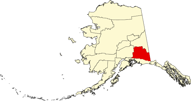
This is a locator map showing Copper River Census Area in Alaska
Summary
[edit]
| Description |
English: This is a locator map showing Copper River Census Area in Alaska - Provisional pending finalisation |
| Date | |
| Source |
Own work
|
| Author | KylieTastic |
| SVG development |
Licensing
[edit]
I, the copyright holder of this work, hereby publish it under the following license:
This file is licensed under the Creative Commons Attribution-Share Alike 4.0 International license.
- You are free:
- to share – to copy, distribute and transmit the work
- to remix – to adapt the work
- Under the following conditions:
- attribution – You must give appropriate credit, provide a link to the license, and indicate if changes were made. You may do so in any reasonable manner, but not in any way that suggests the licensor endorses you or your use.
- share alike – If you remix, transform, or build upon the material, you must distribute your contributions under the same or compatible license as the original.
File history
Click on a date/time to view the file as it appeared at that time.
| Date/Time | Thumbnail | Dimensions | User | Comment | |
|---|---|---|---|---|---|
| current | 20:12, 25 June 2024 | | 1,470 × 777 (644 KB) | Nux (talk | contribs) | uniform colors with good contrast |
| 16:37, 29 February 2020 |  | 1,470 × 777 (373 KB) | KylieTastic (talk | contribs) | User created page with UploadWizard |
You cannot overwrite this file.
File usage on Commons
The following 2 pages use this file:
File usage on other wikis
The following other wikis use this file:
- Usage on de.wikipedia.org
- Usage on en.wikipedia.org
- List of boroughs and census areas in Alaska
- Chisana, Alaska
- Chistochina, Alaska
- Chitina, Alaska
- Copper Center, Alaska
- Copperville, Alaska
- Gakona, Alaska
- Glennallen, Alaska
- Gulkana, Alaska
- Kenny Lake, Alaska
- McCarthy, Alaska
- Mendeltna, Alaska
- Mentasta Lake, Alaska
- Nelchina, Alaska
- Paxson, Alaska
- Silver Springs, Alaska
- Slana, Alaska
- Tazlina, Alaska
- Tolsona, Alaska
- Tonsina, Alaska
- Willow Creek, Alaska
- Kennecott, Alaska
- Kennicott Glacier
- Kuskulana Glacier
- Logan Glacier (Alaska)
- Unorganized Borough, Alaska
- Tazlina Glacier
- Tazlina Lake
- Tana Glacier
- Barnard Glacier
- Hawkins Glacier
- Klutlan Glacier
- University Peak (Alaska)
- Aello Peak
- Mount Bear
- Mount Natazhat
- Gakona River
- Klutina River
- Mentasta Pass
- Mentasta Mountains
- Packsaddle Island
- Template:Unorganized Borough, Alaska
- User:Nyttend/County templates/AK
- Nabesna, Alaska
- Mount Gordon
- Tangle Lakes
- Klawasi group
- Category:Populated places in Unorganized Borough, Alaska
- User:25or6to4/nrhp2
View more global usage of this file.