File:Map lorient.jpg
Jump to navigation
Jump to search
Size of this preview: 514 × 599 pixels. Other resolutions: 206 × 240 pixels | 412 × 480 pixels | 659 × 768 pixels | 879 × 1,024 pixels | 1,847 × 2,152 pixels.
Original file (1,847 × 2,152 pixels, file size: 2.73 MB, MIME type: image/jpeg)
Captions
Captions
Add a one-line explanation of what this file represents
Summary
[edit]
| Description |
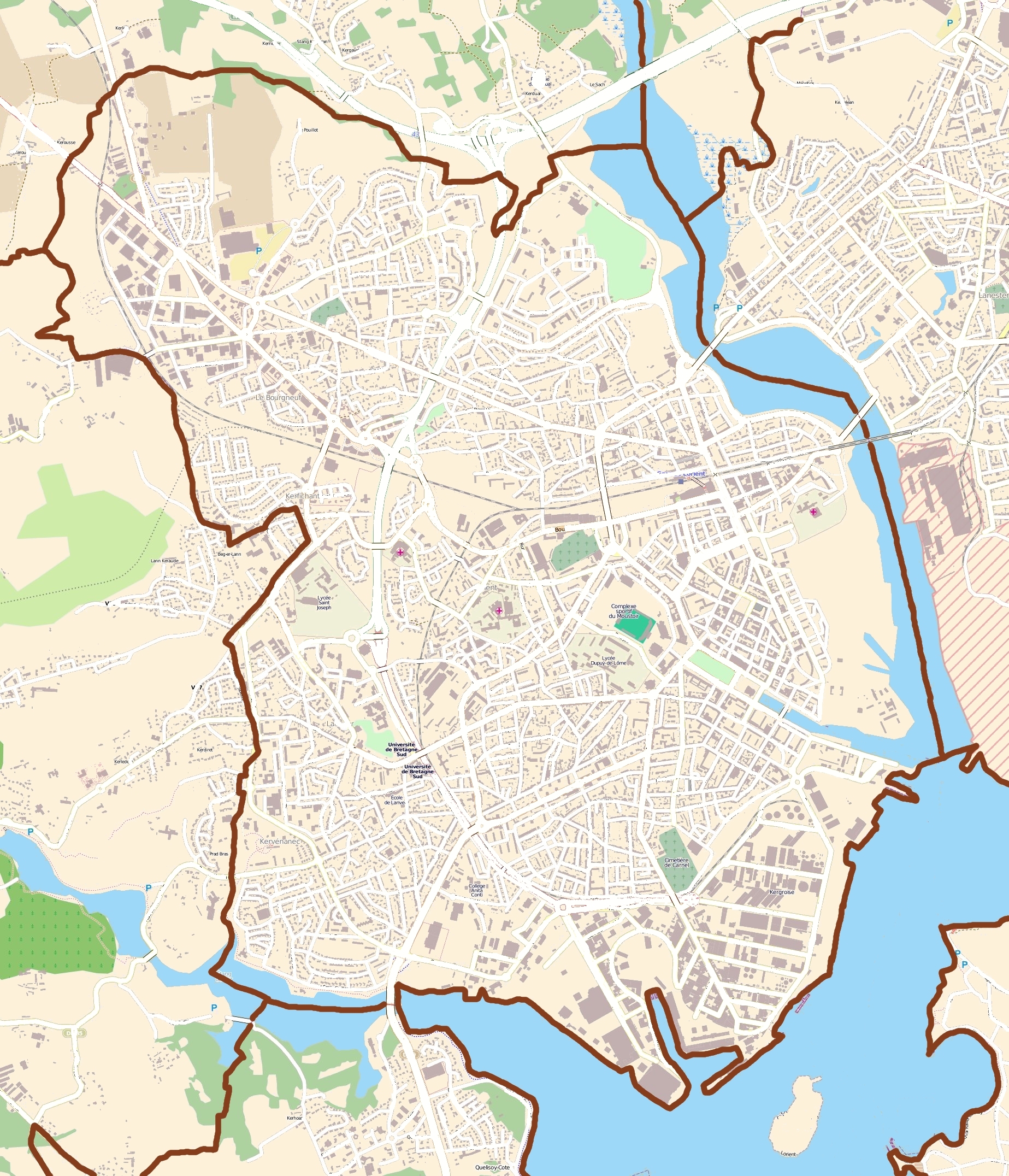
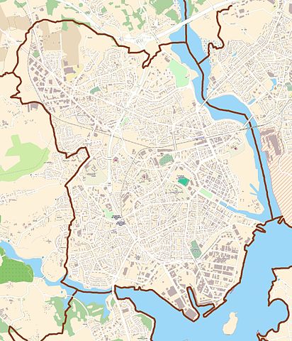
English: Map of Lorient, France
Français : carte de Lorient, France |
||||||||||||
| Date | |||||||||||||
| Source | OpenStreetMap | ||||||||||||
| Author | OpenStreetMap contributors | ||||||||||||
| Permission (Reusing this file) |
|
Licensing
[edit]
This file is licensed under the Creative Commons Attribution-Share Alike 3.0 Unported license.
- You are free:
- to share – to copy, distribute and transmit the work
- to remix – to adapt the work
- Under the following conditions:
- attribution – You must give appropriate credit, provide a link to the license, and indicate if changes were made. You may do so in any reasonable manner, but not in any way that suggests the licensor endorses you or your use.
- share alike – If you remix, transform, or build upon the material, you must distribute your contributions under the same or compatible license as the original.
File history
Click on a date/time to view the file as it appeared at that time.
| Date/Time | Thumbnail | Dimensions | User | Comment | |
|---|---|---|---|---|---|
| current | 12:27, 26 July 2011 | | 1,847 × 2,152 (2.73 MB) | XIIIfromTOKYO (talk | contribs) | rem street names |
| 10:18, 26 July 2011 |  | 1,847 × 2,152 (3.02 MB) | XIIIfromTOKYO (talk | contribs) | {{Information |Description ={{en|1=Map of Lorient, France}} {{fr|1=carte de Lorient, France}} |Source =OpenStreetMap |Author =OpenStreetMap contributors |Date =2011-07-26 |Permission ={{OpenStreetMap}} |other_versions = }} |
You cannot overwrite this file.
File usage on Commons
There are no pages that use this file.
File usage on other wikis
The following other wikis use this file:
- Usage on ar.wikipedia.org
- Usage on azb.wikipedia.org
- Usage on br.wikipedia.org
- Usage on ceb.wikipedia.org
- Usage on da.wikipedia.org
- Usage on en.wikipedia.org
- Usage on es.wikipedia.org
- Usage on fa.wikipedia.org
- Usage on fr.wikipedia.org
- Lorient
- Festival interceltique de Lorient
- Stade du Moustoir
- Keryado
- Chambre de commerce et d'industrie du Morbihan
- Base sous-marine de Lorient
- Cité de la voile Éric Tabarly
- Campus de Lanveur
- Campus de Saint-Maudé
- Centre commercial La Galerie Lanester
- Festival Les Indisciplinées
- Église Notre-Dame-de-Victoire de Lorient
- Presqu'île de Keroman
- Port de pêche de Keroman
- Modèle:Géolocalisation/Lorient
- Port de commerce de Kergroise
- Chapelle Saint-Christophe de Lorient
- Enclos du port
- Hôtel Gabriel
- Tour de la Découverte
- Pont de Kermelo
- Monument expiatoire de Lorient
- Maison (Lorient, 18 rue Jules Legrand)
- Hôpital des armées Calmette
- Île Saint-Michel
- Église Notre-Dame-de-Bonne-Nouvelle de Lorient
- Lycée Dupuy-de-Lôme
- Hôpital du Scorff
- Pont des Indes
- Château de Soye (Morbihan)
- Lycée Colbert de Lorient
- 253 cité de Soye
- Arsenal de Lorient
- SMS Regensburg
- Espace Découverte du sous-marin Flore
View more global usage of this file.