File:Map kiel 1910.jpg
Jump to navigation
Jump to search
Size of this preview: 411 × 599 pixels. Other resolutions: 165 × 240 pixels | 329 × 480 pixels | 822 × 1,198 pixels.
Original file (822 × 1,198 pixels, file size: 426 KB, MIME type: image/jpeg)
Captions
Captions
Add a one-line explanation of what this file represents
Summary
[edit]
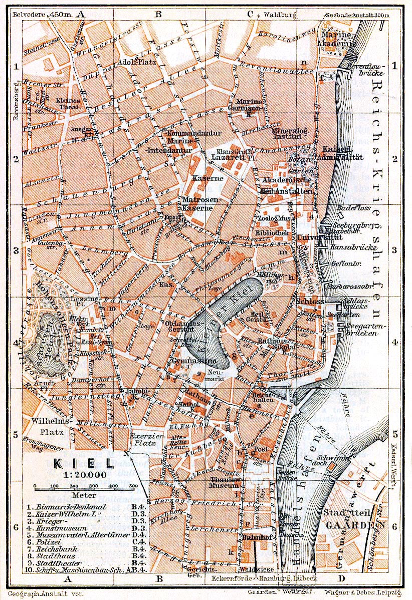
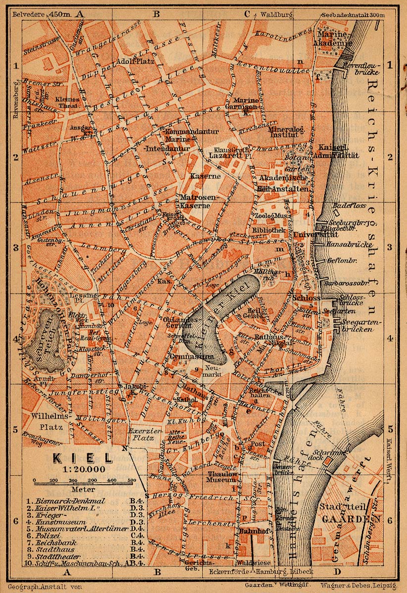
| Description | City map of Kiel, Germany, 1910 |
| Date | |
| Source | http://www.lib.utexas.edu/maps/historical/baedeker_n_germany_1910/kiel_1910.jpg |
| Author | "Northern Germany as far as the Bavarian and Austrian Frontiers; Handbook for Travellers" by Karl Baedeker. Fifteenth Revised Edition. Leipzig, Karl Baedeker; New York, Charles Scribner's Sons 1910. |
| Permission (Reusing this file) |
"Courtesy of the University of Texas Libraries, The University of Texas at Austin." http://www.lib.utexas.edu/maps/map_sites/hist_sites.html |
Licensing
[edit]
|
This work is in the public domain in its country of origin and other countries and areas where the copyright term is the author's life plus 70 years or fewer. | |
| This file has been identified as being free of known restrictions under copyright law, including all related and neighboring rights. | |
File history
Click on a date/time to view the file as it appeared at that time.
| Date/Time | Thumbnail | Dimensions | User | Comment | |
|---|---|---|---|---|---|
| current | 23:33, 26 May 2006 | | 822 × 1,198 (426 KB) | 700 MB (talk | contribs) | even more |
| 23:23, 26 May 2006 |  | 822 × 1,198 (572 KB) | 700 MB (talk | contribs) | tried to remove the stain | |
| 01:49, 23 April 2006 |  | 822 × 1,198 (442 KB) | 700 MB (talk | contribs) | {{Information| |Description=City map of Kiel, Germany, 1910 |Source=http://www.lib.utexas.edu/maps/historical/baedeker_n_germany_1910/kiel_1910.jpg |Date=1910 |Author="Northern Germany as far as the Bavarian and Austrian Frontiers; Handbook for Travellers |
You cannot overwrite this file.
File usage on Commons
There are no pages that use this file.
File usage on other wikis
The following other wikis use this file:
- Usage on de.wikipedia.org
- Usage on de.wikivoyage.org
- Usage on nds.wikipedia.org
- Usage on nn.wikipedia.org
- Usage on no.wikipedia.org