File:Map illustrating the Greco-Turkish War.png
Jump to navigation
Jump to search
Size of this preview: 792 × 600 pixels. Other resolutions: 317 × 240 pixels | 634 × 480 pixels | 1,014 × 768 pixels | 1,280 × 969 pixels | 1,689 × 1,279 pixels.
Original file (1,689 × 1,279 pixels, file size: 912 KB, MIME type: image/png)
Captions
Captions
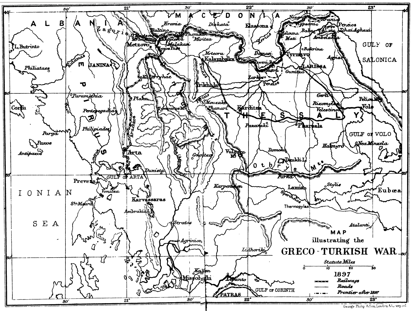
Map of the battlefields of the 1897 Greco-Turkish War
Summary
[edit]
| Description |
English: Map of the regions of southern Epirus and Thessaly, with the main settlements and battle sites of the Greco-Turkish War of 1897 |
| Date | |
| Source | phttps://archive.org/details/scenesinthirtyd01nevigoog/ H. W. Nevinson, Scenes in the thirty days war between Greece & Turkey, 1897, London, J.M. Dent & co., 1898] |
| Author | Nevinson, Henry Woodd, 1856-1941 |
Licensing
[edit]
|
This work is in the public domain in its country of origin and other countries and areas where the copyright term is the author's life plus 70 years or fewer. This work is in the public domain in the United States because it was published (or registered with the U.S. Copyright Office) before January 1, 1929. | |
| This file has been identified as being free of known restrictions under copyright law, including all related and neighboring rights. | |
File history
Click on a date/time to view the file as it appeared at that time.
| Date/Time | Thumbnail | Dimensions | User | Comment | |
|---|---|---|---|---|---|
| current | 16:57, 21 July 2019 | | 1,689 × 1,279 (912 KB) | Cplakidas (talk | contribs) | User created page with UploadWizard |
You cannot overwrite this file.
File usage on Commons
There are no pages that use this file.