File:Map budapest district12.svg
Jump to navigation
Jump to search

Size of this PNG preview of this SVG file: 251 × 251 pixels. Other resolutions: 240 × 240 pixels | 480 × 480 pixels | 768 × 768 pixels | 1,024 × 1,024 pixels | 2,048 × 2,048 pixels.
Original file (SVG file, nominally 251 × 251 pixels, file size: 156 KB)
Captions
Captions
Add a one-line explanation of what this file represents
Summary
[edit]
| Description |
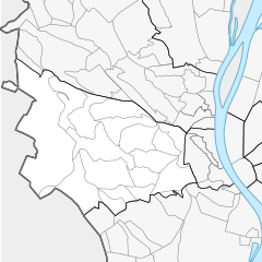
English: Map of Budapest DIstrict XII |
| Date | |
| Source | Own work |
| Author | Ludó |
Licensing
[edit]
I, the copyright holder of this work, hereby publish it under the following license:
This file is licensed under the Creative Commons Attribution-Share Alike 4.0 International license.
- You are free:
- to share – to copy, distribute and transmit the work
- to remix – to adapt the work
- Under the following conditions:
- attribution – You must give appropriate credit, provide a link to the license, and indicate if changes were made. You may do so in any reasonable manner, but not in any way that suggests the licensor endorses you or your use.
- share alike – If you remix, transform, or build upon the material, you must distribute your contributions under the same or compatible license as the original.
File history
Click on a date/time to view the file as it appeared at that time.
| Date/Time | Thumbnail | Dimensions | User | Comment | |
|---|---|---|---|---|---|
| current | 13:17, 6 November 2015 | | 251 × 251 (156 KB) | Ludó (talk | contribs) | User created page with UploadWizard |
You cannot overwrite this file.
File usage on Commons
The following page uses this file:
File usage on other wikis
The following other wikis use this file:
- Usage on fr.wikipedia.org
- 12e arrondissement de Budapest
- Cimetière de Farkasrét
- János-hegy
- Krisztinaváros
- Svábhegy
- Csillebérc
- Farkasrét
- Istenhegy
- Orbánhegy
- Széchenyihegy
- Normafa
- Budakeszierdő
- Jánoshegy
- Sashegy
- Sas-hegy
- Németvölgy
- Kútvölgy
- Farkasvölgy
- Kissvábhegy
- Mártonhegy
- Magasút
- Virányos
- Zugliget
- Observatoire Konkoly
- Quartiers de Budapest
- Modèle:Géolocalisation/12e arrondissement de Budapest
- Darázs forrás
- Disznófő-forrás
- Város-kút (Budapest)
- Cimetière juif de Farkasrét
- Villa Malmos
- Villa Flóra
- Villa Friváldszky-Mauthner-Pálffy
- Villa Gondűző
- Villa Haggenmacher
- Villa Lybasinszky
- Villa Óra
- Villa Stieber
- Villa Szentgyörgyi
- Villa Ürményi-Wagner
- Pin noir de Hangya utca
- Érable plane de Lóránt út
- Hêtre de Svájci út
- Chêne rouvre d'Eötvös út
- Platane de Ráth György utca
- Mûrier de Mártonfa út
- Séquoia géant de Felhő utca
- Réserve naturelle de Kis-sváb-hegy
- Jardin de Csillagvölgy út
- Jardin de Művész út
View more global usage of this file.